Mabilbila Sur geodata
Mabilbila Sur (Ilocos) is a populated place; located in Philippines in Asia/Manila (GMT+8) time zone. With population of 2,408 people, there are 3446 cities with bigger population in this country. Compared to other cities in Philippines, 96.2% of cities are located further ↓South; 92.5% of cities are located further →East and 54.5% of cities have higher elevation than Mabilbila Sur. Note1


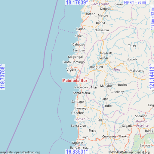
Mabilbila Sur GPS coordinates[2]
17° 30' 25.524" North, 120° 26' 27.6" East
| Map corner | latitude | longitude |
|---|---|---|
| Upper-left | 18.17639°, | 119.73788° |
| Center: | 17.50709°, | 120.441° |
| Lower-right: | 16.83531°, | 121.14413° |
| Map W x H: | 149.1×149.1 km | = 92.6×92.6mi |
| max Lat: | 20.78733° ⇑3.8% North |
| Mabilbila Sur: | 17.50709° |
| min Lat: | ⇓96.2% South 4.65442° |
| min Long | Mabilbila Sur | max Long |
| 117.04868° | 120.441° | 126.58417° |
| W 7.5%⇐ | ⇒92.5% E |
Elevation
Elevation of Mabilbila Sur is 20 m = 66 ft, and this is 67.9 m = 223 ft below average elevation for this country.
| Max E: |
2262 m = 7421 ft | 54.5% |
| Avg. | 87.9 m = 288 ft | |
| Mabilbila Sur | 20 m = 66 ft | |
Min E: |
-2 m = -7 ft | 45.5% |
See also: Philippines elevation on elevation.city.
Geographical zone
Mabilbila Sur is located in North Torrid zone (between Equator and Tropic of Cancer). Distance of this Northern Tropic circle is 659.3 km =409.7 mi to North.| Distance of | km | miles | from Mabilbila Sur |
|---|---|---|---|
| North Pole | 8060.5 | 5008.6 | to North |
| Arctic Circle | 5454.6 | 3389.3 | to North |
| Tropic Cancer | 659.3 | 409.7 | to North |
| Equator | 1946.6 | 1209.6 | to South |


Nearby cities:
15 places around Mabilbila Sur: (largest is in red/bold)
• Bantay
10.2 km =6.3 mi,  327°
327°
• Cabittaogan
11.7 km =7.3 mi,  312°
312°
• Caoayan
7.6 km =4.7 mi,  322°
322°
• Fuerte
8.2 km =5.1 mi,  291°
291°
• Lungog
6.2 km =3.9 mi,  140°
140°
• Nagbukel
11.1 km =6.9 mi,  126°
126°
• Narvacan
10.6 km =6.6 mi,  159°
159°
• Pudoc North
13.7 km =8.5 mi, 326°
• Quinarayan
7.7 km =4.8 mi,  154°
154°
• San Ildefonso
13.6 km =8.5 mi,  339°
339°
• San Quintin
9.2 km =5.7 mi,  64°
64°
• San Vicente
12.3 km =7.6 mi, 324°
• Santa
2.4 km =1.5 mi,  195°
195°
• Santa Catalina
13.2 km =8.2 mi, 318°
• Vigan
9.5 km =5.9 mi, 322°
Sources, notices
• [Note1] Compared only with cities in Philippines existing in our database
• [Src1] Map data: © OpenStreetMap contributors (CC-BY-SA)
• [Src2] Other city data from geonames.org with taken over terms of usage.
• [Src3] Geographical zone / Annual Mean Temperature by Robert A. Rohde @ Wikipedia
