Ondoy geodata
Ondoy (Western Visayas) is a populated place; located in Philippines in Asia/Manila (GMT+8) time zone. With population of 2,041 people, there are 4136 cities with bigger population in this country. Compared to other cities in Philippines, 51% of cities are located further ↓South; 58.8% of cities are located further →East and 73.2% of cities have higher elevation than Ondoy. Note1


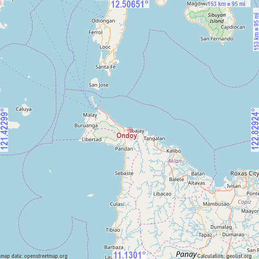
Ondoy GPS coordinates[2]
11° 49' 9.012" North, 122° 7' 33.996" East
| Map corner | latitude | longitude |
|---|---|---|
| Upper-left | 12.50651°, | 121.42299° |
| Center: | 11.81917°, | 122.12611° |
| Lower-right: | 11.1301°, | 122.82924° |
| Map W x H: | 153×153 km | = 95.1×95.1mi |
| max Lat: | 20.78733° ⇑49% North |
| Ondoy: | 11.81917° |
| min Lat: | ⇓51% South 4.65442° |
| min Long | Ondoy | max Long |
| 117.04868° | 122.12611° | 126.58417° |
| W 41.2%⇐ | ⇒58.8% E |
Elevation
Elevation of Ondoy is 11 m = 36 ft, and this is 76.9 m = 252 ft below average elevation for this country.
| Max E: |
2262 m = 7421 ft | 73.2% |
| Avg. | 87.9 m = 288 ft | |
| Ondoy | 11 m = 36 ft | |
Min E: |
-2 m = -7 ft | 26.8% |
See also: Philippines elevation on elevation.city.
Geographical zone
Ondoy is located in North Torrid zone (between Equator and Tropic of Cancer). Distance of this Northern Tropic circle is 1291.8 km =802.7 mi to North.| Distance of | km | miles | from Ondoy |
|---|---|---|---|
| North Pole | 8692.9 | 5401.5 | to North |
| Arctic Circle | 6087 | 3782.3 | to North |
| Tropic Cancer | 1291.8 | 802.7 | to North |
| Equator | 1314.2 | 816.6 | to South |


Nearby cities:
15 places around Ondoy: (largest is in red/bold)
• Aquino
1.9 km =1.2 mi,  279°
279°
• Gibong
10.6 km =6.6 mi,  297°
297°
• Ibajay
3.9 km =2.4 mi,  88°
88°
• Idio
21.9 km =13.6 mi,  188°
188°
• Makato
21.7 km =13.5 mi,  123°
123°
• Maloco
4.9 km =3 mi,  144°
144°
• Nabas
4.5 km =2.8 mi,  287°
287°
• Naili
8 km =5 mi, 136°
• Naisud
7.5 km =4.7 mi,  101°
101°
• Panayacan
12.5 km =7.8 mi, 121°
• Pandan
8.7 km =5.4 mi,  198°
198°
• Pandan
11.6 km =7.2 mi, 197°
• Patria
14.8 km =9.2 mi,  233°
233°
• Tangalan
15.6 km =9.7 mi,  106°
106°
• Unidos
16.8 km =10.4 mi,  305°
305°
Sources, notices
• [Note1] Compared only with cities in Philippines existing in our database
• [Src1] Map data: © OpenStreetMap contributors (CC-BY-SA)
• [Src2] Other city data from geonames.org with taken over terms of usage.
• [Src3] Geographical zone / Annual Mean Temperature by Robert A. Rohde @ Wikipedia
