Medina geodata
Medina (Northern Mindanao) is a seat of a third-order administrative division; located in Philippines in Asia/Manila (GMT+8) time zone. With population of 9,201 people, there are 668 cities with bigger population in this country. Compared to other cities in Philippines, 76.4% of cities are located further ↑North; 88.2% of cities are located further ←West and 85.4% of cities have higher elevation than Medina. Note1
Administrative division(s):
- Level 1: Northern Mindanao
- Level 2: Province of Misamis Oriental
- Level 3: Medina


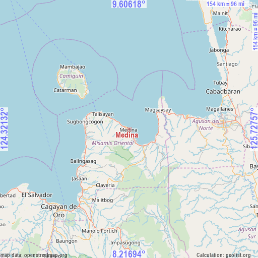
Medina GPS coordinates[2]
8° 54' 43.992" North, 125° 1' 27.984" East
| Map corner | latitude | longitude |
|---|---|---|
| Upper-left | 9.60618°, | 124.32132° |
| Center: | 8.91222°, | 125.02444° |
| Lower-right: | 8.21694°, | 125.72757° |
| Map W x H: | 154.5×154.5 km | = 96×96mi |
| max Lat: | 20.78733° ⇑76.4% North |
| Medina: | 8.91222° |
| min Lat: | ⇓23.6% South 4.65442° |
| min Long | Medina | max Long |
| 117.04868° | 125.02444° | 126.58417° |
| W 88.2%⇐ | ⇒11.8% E |
Elevation
Elevation of Medina is 8 m = 26 ft, and this is 79.9 m = 262 ft below average elevation for this country.
| Max E: |
2262 m = 7421 ft | 85.4% |
| Avg. | 87.9 m = 288 ft | |
| Medina | 8 m = 26 ft | |
Min E: |
-2 m = -7 ft | 14.6% |
See also: Philippines elevation on elevation.city.
Geographical zone
Medina is located in North Torrid zone (between Equator and Tropic of Cancer). Distance of Equator is 990.9 km =615.7 mi to South.| Distance of | km | miles | from Medina |
|---|---|---|---|
| North Pole | 9016.1 | 5602.3 | to North |
| Arctic Circle | 6410.2 | 3983.1 | to North |
| Tropic Cancer | 1615 | 1003.5 | to North |
| Equator | 990.9 | 615.7 | to South |


Nearby cities:
15 places around Medina: (largest is in red/bold)
• Anakan
15.7 km =9.8 mi,  117°
117°
• Balingoan
21.5 km =13.4 mi,  298°
298°
• Candiis
18.7 km =11.6 mi,  69°
69°
• Consuelo
18 km =11.2 mi,  93°
93°
• Kibonsod
22.9 km =14.2 mi,  62°
62°
• Lunao
7.7 km =4.8 mi,  152°
152°
• Maanas
2.2 km =1.4 mi,  160°
160°
• Magsaysay
21.1 km =13.1 mi, 55°
• Malinaw
20.9 km =13 mi, 117°
• Mananum
12 km =7.5 mi,  222°
222°
• Mariano
13.4 km =8.3 mi,  130°
130°
• Minlagas
4.1 km =2.5 mi, 157°
• Odiongan
17.3 km =10.7 mi, 115°
• Taboc
25.2 km =15.7 mi,  261°
261°
• Talisayan
18.6 km =11.6 mi, 301°
Sources, notices
• [Note1] Compared only with cities in Philippines existing in our database
• [Src1] Map data: © OpenStreetMap contributors (CC-BY-SA)
• [Src2] Other city data from geonames.org with taken over terms of usage.
• [Src3] Geographical zone / Annual Mean Temperature by Robert A. Rohde @ Wikipedia
