Lawa-an geodata
Lawa-an (Eastern Visayas) is a seat of a third-order administrative division; located in Philippines in Asia/Manila (GMT+8) time zone. In our database, there are 4166 cities with bigger population. Compared to other cities in Philippines, 55.3% of cities are located further ↑North; 91.4% of cities are located further ←West and 95.5% of cities have higher elevation than Lawa-an. Note1
Administrative division(s):
- Level 1: Eastern Visayas
- Level 2: Province of Eastern Samar
- Level 3: Lawaan


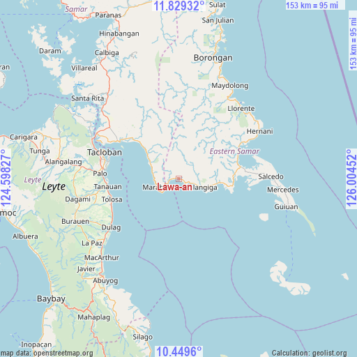
Lawa-an GPS coordinates[2]
11° 8' 25.008" North, 125° 18' 5.004" East
| Map corner | latitude | longitude |
|---|---|---|
| Upper-left | 11.82932°, | 124.59827° |
| Center: | 11.14028°, | 125.30139° |
| Lower-right: | 10.4496°, | 126.00452° |
| Map W x H: | 153.4×153.4 km | = 95.3×95.3mi |
| max Lat: | 20.78733° ⇑55.3% North |
| Lawa-an: | 11.14028° |
| min Lat: | ⇓44.7% South 4.65442° |
| min Long | Lawa-an | max Long |
| 117.04868° | 125.30139° | 126.58417° |
| W 91.4%⇐ | ⇒8.6% E |
Elevation
Elevation of Lawa-an is 5 m = 16 ft, and this is 82.9 m = 272 ft below average elevation for this country.
| Max E: |
2262 m = 7421 ft | 95.5% |
| Avg. | 87.9 m = 288 ft | |
| Lawa-an | 5 m = 16 ft | |
Min E: |
-2 m = -7 ft | 4.5% |
See also: Philippines elevation on elevation.city.
Geographical zone
Lawa-an is located in North Torrid zone (between Equator and Tropic of Cancer). Distance of Equator is 1238.7 km =769.7 mi to South.| Distance of | km | miles | from Lawa-an |
|---|---|---|---|
| North Pole | 8768.4 | 5448.4 | to North |
| Arctic Circle | 6162.5 | 3829.2 | to North |
| Tropic Cancer | 1367.2 | 849.5 | to North |
| Equator | 1238.7 | 769.7 | to South |


Nearby cities:
15 places around Lawa-an: (largest is in red/bold)
• Balangiga
10 km =6.2 mi,  109°
109°
• Baras
31.4 km =19.5 mi,  278°
278°
• Basey
29.8 km =18.5 mi,  301°
301°
• Bislig
30.2 km =18.8 mi,  255°
255°
• General MacArthur
28.5 km =17.7 mi,  65°
65°
• Giporlos
16.3 km =10.1 mi,  97°
97°
• Guirang
30.8 km =19.1 mi,  319°
319°
• Kabuynan
30.9 km =19.2 mi, 257°
• Palo
33.9 km =21.1 mi,  273°
273°
• Pawing
32.9 km =20.4 mi, 277°
• Quinapundan
24.1 km =15 mi,  85°
85°
• San Jose
33.6 km =20.9 mi,  239°
239°
• San Roque
32.6 km =20.3 mi,  252°
252°
• Tanauan
31.4 km =19.5 mi, 263°
• Tolosa
31.4 km =19.5 mi, 261°
Sources, notices
• [Note1] Compared only with cities in Philippines existing in our database
• [Src1] Map data: © OpenStreetMap contributors (CC-BY-SA)
• [Src2] Other city data from geonames.org with taken over terms of usage.
• [Src3] Geographical zone / Annual Mean Temperature by Robert A. Rohde @ Wikipedia
