Kabuynan geodata
Kabuynan (Eastern Visayas) is a populated place; located in Philippines in Asia/Manila (GMT+8) time zone. With population of 2,569 people, there are 3167 cities with bigger population in this country. Compared to other cities in Philippines, 56% of cities are located further ↑North; 88.2% of cities are located further ←West and 92.7% of cities have higher elevation than Kabuynan. Note1


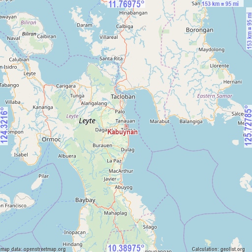
Kabuynan GPS coordinates[2]
11° 4' 50.016" North, 125° 1' 28.992" East
| Map corner | latitude | longitude |
|---|---|---|
| Upper-left | 11.76975°, | 124.3216° |
| Center: | 11.08056°, | 125.02472° |
| Lower-right: | 10.38975°, | 125.72785° |
| Map W x H: | 153.4×153.4 km | = 95.3×95.3mi |
| max Lat: | 20.78733° ⇑56% North |
| Kabuynan: | 11.08056° |
| min Lat: | ⇓44% South 4.65442° |
| min Long | Kabuynan | max Long |
| 117.04868° | 125.02472° | 126.58417° |
| W 88.2%⇐ | ⇒11.8% E |
Elevation
Elevation of Kabuynan is 6 m = 20 ft, and this is 81.9 m = 269 ft below average elevation for this country.
| Max E: |
2262 m = 7421 ft | 92.7% |
| Avg. | 87.9 m = 288 ft | |
| Kabuynan | 6 m = 20 ft | |
Min E: |
-2 m = -7 ft | 7.3% |
See also: Philippines elevation on elevation.city.
Geographical zone
Kabuynan is located in North Torrid zone (between Equator and Tropic of Cancer). Distance of Equator is 1232 km =765.5 mi to South.| Distance of | km | miles | from Kabuynan |
|---|---|---|---|
| North Pole | 8775 | 5452.5 | to North |
| Arctic Circle | 6169.1 | 3833.3 | to North |
| Tropic Cancer | 1373.9 | 853.7 | to North |
| Equator | 1232 | 765.5 | to South |


Nearby cities:
15 places around Kabuynan: (largest is in red/bold)
• Baras
11.5 km =7.1 mi,  355°
355°
• Bislig
1.3 km =0.8 mi,  132°
132°
• Cabacuñgan
17 km =10.6 mi,  196°
196°
• Dagami
13.5 km =8.4 mi,  260°
260°
• Dulag
14.3 km =8.9 mi,  176°
176°
• Julita
13.6 km =8.5 mi,  210°
210°
• Palo
9.3 km =5.8 mi,  336°
336°
• Pastrana
16.4 km =10.2 mi,  292°
292°
• Pawing
11.3 km =7 mi,  347°
347°
• San Jose
10.3 km =6.4 mi,  173°
173°
• San Roque
3.5 km =2.2 mi,  194°
194°
• Santa Fe
16.6 km =10.3 mi,  314°
314°
• Tabontabon
8.2 km =5.1 mi,  237°
237°
• Tanauan
3.4 km =2.1 mi, 342°
• Tolosa
2.3 km =1.4 mi, 337°
Sources, notices
• [Note1] Compared only with cities in Philippines existing in our database
• [Src1] Map data: © OpenStreetMap contributors (CC-BY-SA)
• [Src2] Other city data from geonames.org with taken over terms of usage.
• [Src3] Geographical zone / Annual Mean Temperature by Robert A. Rohde @ Wikipedia
