Burgos geodata
Burgos (Ilocos) is a seat of a third-order administrative division; located in Philippines in Asia/Manila (GMT+8) time zone. In our database, there are 4166 cities with bigger population. Compared to other cities in Philippines, 95.3% of cities are located further ↓South; 90.9% of cities are located further →East and 53.1% of cities have higher elevation than Burgos. Note1


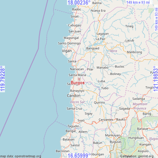
Burgos GPS coordinates[2]
17° 19' 56.64" North, 120° 29' 43.44" East
| Map corner | latitude | longitude |
|---|---|---|
| Upper-left | 18.00236°, | 119.79228° |
| Center: | 17.3324°, | 120.4954° |
| Lower-right: | 16.65999°, | 121.19853° |
| Map W x H: | 149.3×149.3 km | = 92.8×92.8mi |
| max Lat: | 20.78733° ⇑4.7% North |
| Burgos: | 17.3324° |
| min Lat: | ⇓95.3% South 4.65442° |
| min Long | Burgos | max Long |
| 117.04868° | 120.4954° | 126.58417° |
| W 9.1%⇐ | ⇒90.9% E |
Elevation
Elevation of Burgos is 21 m = 69 ft, and this is 66.9 m = 219 ft below average elevation for this country.
| Max E: |
2262 m = 7421 ft | 53.1% |
| Avg. | 87.9 m = 288 ft | |
| Burgos | 21 m = 69 ft | |
Min E: |
-2 m = -7 ft | 46.9% |
See also: Philippines elevation on elevation.city.
Geographical zone
Burgos is located in North Torrid zone (between Equator and Tropic of Cancer). Distance of this Northern Tropic circle is 678.7 km =421.7 mi to North.| Distance of | km | miles | from Burgos |
|---|---|---|---|
| North Pole | 8079.9 | 5020.6 | to North |
| Arctic Circle | 5474 | 3401.4 | to North |
| Tropic Cancer | 678.7 | 421.7 | to North |
| Equator | 1927.2 | 1197.5 | to South |


Nearby cities:
15 places around Burgos: (largest is in red/bold)
• Banayoyo
11.1 km =6.9 mi,  186°
186°
• Candon
16 km =9.9 mi,  196°
196°
• Caterman
14.8 km =9.2 mi,  210°
210°
• Lidlidda
7.5 km =4.7 mi,  158°
158°
• Lungog
14.8 km =9.2 mi,  352°
352°
• Nagbukel
13.1 km =8.1 mi,  13°
13°
• Narvacan
9.7 km =6 mi, 347°
• Pilar
14.1 km =8.8 mi,  48°
48°
• Quinarayan
12.7 km =7.9 mi, 348°
• San Esteban
5.3 km =3.3 mi,  267°
267°
• Santa Maria
4.1 km =2.5 mi,  337°
337°
• Santiago
6.9 km =4.3 mi,  231°
231°
• Suso
4.7 km =2.9 mi,  309°
309°
• Tablac
13.7 km =8.5 mi, 198°
• Tamorong
6.6 km =4.1 mi, 270°
Sources, notices
• [Note1] Compared only with cities in Philippines existing in our database
• [Src1] Map data: © OpenStreetMap contributors (CC-BY-SA)
• [Src2] Other city data from geonames.org with taken over terms of usage.
• [Src3] Geographical zone / Annual Mean Temperature by Robert A. Rohde @ Wikipedia
