Grabiszyn geodata
Grabiszyn (Lower Silesia) is a section of populated place; located in Poland in Europe/Warsaw (GMT+2) time zone. With population of 2,175 people, there are 1382 cities with bigger population in this country. Compared to other cities in Poland, 52.8% of cities are located further ↑North; 85.1% of cities are located further →East and 68.2% of cities have higher elevation than Grabiszyn. Note1
Administrative division(s):
- Level 1: Lower Silesia
- Level 2: Wrocław
- Level 3: Wrocław
- Level 4: Grabiszyn - Grabiszynek


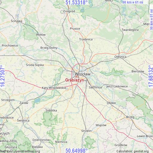
Grabiszyn GPS coordinates[2]
51° 5' 37.284" North, 16° 58' 41.484" East
| Map corner | latitude | longitude |
|---|---|---|
| Upper-left | 51.53318°, | 16.27507° |
| Center: | 51.09369°, | 16.97819° |
| Lower-right: | 50.64998°, | 17.68132° |
| Map W x H: | 98.2×98.2 km | = 61×61mi |
| max Lat: | 54.83135° ⇑52.8% North |
| Grabiszyn: | 51.09369° |
| min Lat: | ⇓47.2% South 49.21328° |
| min Long | Grabiszyn | max Long |
| 14.20249° | 16.97819° | 24.03723° |
| W 14.9%⇐ | ⇒85.1% E |
Elevation
Elevation of Grabiszyn is 125 m = 410 ft, and this is 66.4 m = 218 ft below average elevation for this country.
| Max E: |
974 m = 3196 ft | 68.2% |
| Avg. | 191.4 m = 628 ft | |
| Grabiszyn | 125 m = 410 ft | |
Min E: |
-3 m = -10 ft | 31.8% |
See also: Poland elevation on elevation.city.
Geographical zone
Grabiszyn is located in North temperate zone (between Tropic of Cancer and the Arctic Circle). Distance of this North polar circle is 1720.1 km =1068.8 mi to North.| Distance of | km | miles | from Grabiszyn |
|---|---|---|---|
| North Pole | 4326 | 2688.1 | to North |
| Arctic Circle | 1720.1 | 1068.8 | to North |
| Tropic Cancer | 3075.2 | 1910.8 | to South |
| Equator | 5681.1 | 3530.1 | to South |


Nearby cities:
15 places around Grabiszyn: (largest is in red/bold)
• Grabiszynek
0.9 km =0.6 mi,  142°
142°
• Gądów Mały
2.8 km =1.7 mi,  11°
11°
• Krzyki
2.8 km =1.7 mi,  155°
155°
• Osiedle Henrykowskie
5.2 km =3.2 mi,  94°
94°
• Osiedle Kosmonautów
3.9 km =2.4 mi,  343°
343°
• Partynice
3.8 km =2.4 mi, 138°
• Pilczyce
5 km =3.1 mi, 343°
• Powstańców Śląskich Wschód
3.3 km =2.1 mi, 94°
• Powstańców Śląskich Zachód-Centrum Południow
2.8 km =1.7 mi,  84°
84°
• Rejon placu Świętego Macieja
5.1 km =3.2 mi,  54°
54°
• Rejon ulicy Borowskiej-Południe
3.8 km =2.4 mi,  119°
119°
• Rejon ulicy Mieleckiej
1.7 km =1.1 mi,  98°
98°
• Rejon ulicy Saperów
1.8 km =1.1 mi, 118°
• Rejon ulicy Traugutta
5 km =3.1 mi, 78°
• Wrocław
3.9 km =2.4 mi, 79°
Sources, notices
• [Note1] Compared only with cities in Poland existing in our database
• [Src1] Map data: © OpenStreetMap contributors (CC-BY-SA)
• [Src2] Other city data from geonames.org with taken over terms of usage.
• [Src3] Geographical zone / Annual Mean Temperature by Robert A. Rohde @ Wikipedia
