Yuta geodata
Yuta (West Bank) is a populated place; located in Palestinian Territory in Asia/Hebron (GMT+3) time zone. With population of 41,425 people, there are 11 cities with bigger population in this country. Compared to other cities in Palestinian Territory, 92.4% of cities are located further ↑North; 70.2% of cities are located further →East and 88.5% of cities have lower elevation than Yuta. Note1


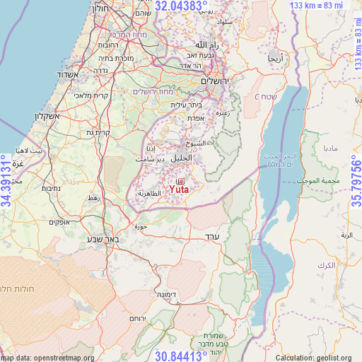
Yuta GPS coordinates[2]
31° 26' 45.24" North, 35° 5' 39.948" East
| Map corner | latitude | longitude |
|---|---|---|
| Upper-left | 32.04383°, | 34.39131° |
| Center: | 31.4459°, | 35.09443° |
| Lower-right: | 30.84413°, | 35.79756° |
| Map W x H: | 133.4×133.4 km | = 82.9×82.9mi |
| max Lat: | 32.54346° ⇑92.4% North |
| Yuta: | 31.4459° |
| min Lat: | ⇓7.6% South 31.25997° |
| min Long | Yuta | max Long |
| 34.24357° | 35.09443° | 35.53898° |
| W 29.8%⇐ | ⇒70.2% E |
Elevation
Elevation of Yuta is 808 m = 2651 ft, and this is 334.7 m = 1098 ft above average elevation for this country.
| Max E: |
999 m = 3278 ft | 11.5% |
| Yuta | 808 m 2651 ft | |
| Avg. | 473.3 m = 1553 ft | |
Min E: |
-269 m = -883 ft | 88.5% |
See also: Yuta elevation on elevation.city.
Geographical zone
Yuta is located in North temperate zone (between Tropic of Cancer and the Arctic Circle). Distance of this Northern Tropic circle is 890.5 km =553.3 mi to South.| Distance of | km | miles | from Yuta |
|---|---|---|---|
| North Pole | 6510.6 | 4045.5 | to North |
| Arctic Circle | 3904.7 | 2426.3 | to North |
| Tropic Cancer | 890.5 | 553.3 | to South |
| Equator | 3496.5 | 2172.6 | to South |


Nearby cities:
15 places around Yuta: (largest is in red/bold)
• Ad Dayrāt
6.6 km =4.1 mi,  92°
92°
• Al Buwayb
5.8 km =3.6 mi,  69°
69°
• Al Buwayrah
5.1 km =3.2 mi,  24°
24°
• Al Karmil
4.4 km =2.7 mi,  124°
124°
• Al Ḩīlah
3.4 km =2.1 mi, 21°
• Ar Rīḩīyah
3.1 km =1.9 mi,  329°
329°
• As Samū‘
6.1 km =3.8 mi,  206°
206°
• Bayt ‘Amrah
4.3 km =2.7 mi,  276°
276°
• Karmah
6.4 km =4 mi, 275°
• Khallat ad Dār
6 km =3.7 mi, 17°
• Khallat al Mayyah
4.6 km =2.9 mi,  95°
95°
• Khallat Şāliḩ
3.5 km =2.2 mi,  145°
145°
• Qalqas
5.1 km =3.2 mi,  0°
0°
• Umm Laşafā
6 km =3.7 mi, 100°
• Zīf
4.6 km =2.9 mi,  59°
59°
Sources, notices
• [Note1] Compared only with cities in Palestinian Territory existing in our database
• [Src1] Map data: © OpenStreetMap contributors (CC-BY-SA)
• [Src2] Other city data from geonames.org with taken over terms of usage.
• [Src3] Geographical zone / Annual Mean Temperature by Robert A. Rohde @ Wikipedia
