Marj Na‘jah geodata
Marj Na‘jah (West Bank) is a populated place; located in Palestinian Territory in Asia/Hebron (GMT+3) time zone. With population of 706 people, there are 366 cities with bigger population in this country. Compared to other cities in Palestinian Territory, 67.7% of cities are located further ↓South; 100% of cities are located further ←West and 100% of cities have higher elevation than Marj Na‘jah. Note1


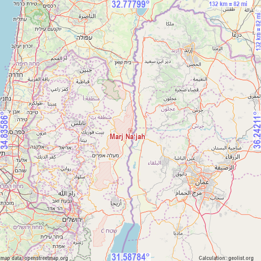
Marj Na‘jah GPS coordinates[2]
32° 11' 5.496" North, 35° 32' 20.328" East
| Map corner | latitude | longitude |
|---|---|---|
| Upper-left | 32.77799°, | 34.83586° |
| Center: | 32.18486°, | 35.53898° |
| Lower-right: | 31.58784°, | 36.24211° |
| Map W x H: | 132.3×132.3 km | = 82.2×82.2mi |
| max Lat: | 32.54346° ⇑32.3% North |
| Marj Na‘jah: | 32.18486° |
| min Lat: | ⇓67.7% South 31.25997° |
| min Long | Marj Na‘jah | max Long |
| 34.24357° | 35.53898° | 35.53898° |
| W 100%⇐ | ⇒0% E |
Elevation
Elevation of Marj Na‘jah is -269 m = -883 ft, and this is 742.3 m = 2435 ft below average elevation for this country.
| Max E: |
999 m = 3278 ft | 100% |
| Avg. | 473.3 m = 1553 ft | |
| Marj Na‘jah | -269 m = -883 ft | |
Min E: |
-269 m = -883 ft | 0% |
See also: Palestinian Territory elevation on elevation.city.
Geographical zone
Marj Na‘jah is located in North temperate zone (between Tropic of Cancer and the Arctic Circle). Distance of this Northern Tropic circle is 972.7 km =604.4 mi to South.| Distance of | km | miles | from Marj Na‘jah |
|---|---|---|---|
| North Pole | 6428.4 | 3994.4 | to North |
| Arctic Circle | 3822.6 | 2375.3 | to North |
| Tropic Cancer | 972.7 | 604.4 | to South |
| Equator | 3578.6 | 2223.6 | to South |


Nearby cities:
15 places around Marj Na‘jah: (largest is in red/bold)
• Al Bādhān
21.1 km =13.1 mi,  292°
292°
• Al Faşāyil
19.9 km =12.4 mi,  206°
206°
• Al Jiftlik
6.9 km =4.3 mi,  224°
224°
• Al ‘Aqrabānīyah
16.9 km =10.5 mi,  296°
296°
• An Naşşārīyah
15.4 km =9.6 mi, 291°
• Ath Thaghrah
21.4 km =13.3 mi,  319°
319°
• Az Zubaydāt
1.5 km =0.9 mi, 213°
• Bayt Dajan
15.8 km =9.8 mi,  273°
273°
• Bayt Fūrīk
19.2 km =11.9 mi, 267°
• Bayt Ḩasan
14 km =8.7 mi, 294°
• Dayr al Ḩaţab
20.8 km =12.9 mi,  279°
279°
• Majdal Banī Fāḑil
20 km =12.4 mi,  235°
235°
• Sālim
19.8 km =12.3 mi, 277°
• Ţammūn
18.3 km =11.4 mi,  306°
306°
• ‘Aqrabā
19.4 km =12.1 mi,  249°
249°
Sources, notices
• [Note1] Compared only with cities in Palestinian Territory existing in our database
• [Src1] Map data: © OpenStreetMap contributors (CC-BY-SA)
• [Src2] Other city data from geonames.org with taken over terms of usage.
• [Src3] Geographical zone / Annual Mean Temperature by Robert A. Rohde @ Wikipedia
