Bayt ‘Anān geodata
Bayt ‘Anān (West Bank) is a populated place; located in Palestinian Territory in Asia/Hebron (GMT+3) time zone. With population of 3,946 people, there are 138 cities with bigger population in this country. Compared to other cities in Palestinian Territory, 67.4% of cities are located further ↑North; 66.2% of cities are located further →East and 73.8% of cities have lower elevation than Bayt ‘Anān. Note1


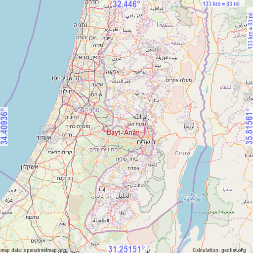
Bayt ‘Anān GPS coordinates[2]
31° 51' 2.484" North, 35° 6' 44.928" East
| Map corner | latitude | longitude |
|---|---|---|
| Upper-left | 32.446°, | 34.40936° |
| Center: | 31.85069°, | 35.11248° |
| Lower-right: | 31.25151°, | 35.81561° |
| Map W x H: | 132.8×132.8 km | = 82.5×82.5mi |
| max Lat: | 32.54346° ⇑67.4% North |
| Bayt ‘Anān: | 31.85069° |
| min Lat: | ⇓32.6% South 31.25997° |
| min Long | Bayt ‘Anān | max Long |
| 34.24357° | 35.11248° | 35.53898° |
| W 33.8%⇐ | ⇒66.2% E |
Elevation
Elevation of Bayt ‘Anān is 680 m = 2231 ft, and this is 206.7 m = 678 ft above average elevation for this country.
| Max E: |
999 m = 3278 ft | 26.2% |
| Bayt ‘Anān | 680 m 2231 ft | |
| Avg. | 473.3 m = 1553 ft | |
Min E: |
-269 m = -883 ft | 73.8% |
See also: Palestinian Territory elevation on elevation.city.
Geographical zone
Bayt ‘Anān is located in North temperate zone (between Tropic of Cancer and the Arctic Circle). Distance of this Northern Tropic circle is 935.5 km =581.3 mi to South.| Distance of | km | miles | from Bayt ‘Anān |
|---|---|---|---|
| North Pole | 6465.6 | 4017.5 | to North |
| Arctic Circle | 3859.7 | 2398.3 | to North |
| Tropic Cancer | 935.5 | 581.3 | to South |
| Equator | 3541.5 | 2200.6 | to South |


Nearby cities:
15 places around Bayt ‘Anān: (largest is in red/bold)
• Al Jīb
6.8 km =4.2 mi,  88°
88°
• Al Qubaybah
2.6 km =1.6 mi,  119°
119°
• Aţ Ţīrah
2.6 km =1.6 mi,  31°
31°
• Bayt Duqqū
2 km =1.2 mi,  62°
62°
• Bayt Ijzā
3.7 km =2.3 mi,  96°
96°
• Bayt Iksā
7.3 km =4.5 mi, 120°
• Bayt Liqyā
4.9 km =3 mi,  295°
295°
• Bayt Sūrīk
4.6 km =2.9 mi,  130°
130°
• Bayt ‘Ūr al Fawqā
3.9 km =2.4 mi,  4°
4°
• Bayt ‘Ūr at Taḩtā
5.8 km =3.6 mi,  330°
330°
• Biddū
3.9 km =2.4 mi, 116°
• Givat Zeev
5.4 km =3.4 mi,  77°
77°
• Kharbathā al Mişbāḩ
5.4 km =3.4 mi,  315°
315°
• Qaţanah
2 km =1.2 mi,  162°
162°
• ‘Ayn ‘Arīk
6.8 km =4.2 mi,  24°
24°
Sources, notices
• [Note1] Compared only with cities in Palestinian Territory existing in our database
• [Src1] Map data: © OpenStreetMap contributors (CC-BY-SA)
• [Src2] Other city data from geonames.org with taken over terms of usage.
• [Src3] Geographical zone / Annual Mean Temperature by Robert A. Rohde @ Wikipedia
