Al Ittiḩād geodata
Al Ittiḩād (West Bank) is a populated place; located in Palestinian Territory in Asia/Hebron (GMT+3) time zone. With population of 2,978 people, there are 174 cities with bigger population in this country. Compared to other cities in Palestinian Territory, 53.9% of cities are located further ↑North; 64.6% of cities are located further →East and 60.3% of cities have lower elevation than Al Ittiḩād. Note1


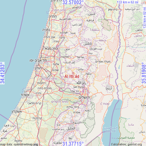
Al Ittiḩād GPS coordinates[2]
31° 58' 31.872" North, 35° 6' 57.42" East
| Map corner | latitude | longitude |
|---|---|---|
| Upper-left | 32.57002°, | 34.41283° |
| Center: | 31.97552°, | 35.11595° |
| Lower-right: | 31.37715°, | 35.81908° |
| Map W x H: | 132.6×132.6 km | = 82.4×82.4mi |
| max Lat: | 32.54346° ⇑53.9% North |
| Al Ittiḩād: | 31.97552° |
| min Lat: | ⇓46.1% South 31.25997° |
| min Long | Al Ittiḩād | max Long |
| 34.24357° | 35.11595° | 35.53898° |
| W 35.4%⇐ | ⇒64.6% E |
Elevation
Elevation of Al Ittiḩād is 558 m = 1831 ft, and this is 84.7 m = 278 ft above average elevation for this country.
| Max E: |
999 m = 3278 ft | 39.7% |
| Al Ittiḩād | 558 m 1831 ft | |
| Avg. | 473.3 m = 1553 ft | |
Min E: |
-269 m = -883 ft | 60.3% |
See also: Palestinian Territory elevation on elevation.city.
Geographical zone
Al Ittiḩād is located in North temperate zone (between Tropic of Cancer and the Arctic Circle). Distance of this Northern Tropic circle is 949.4 km =589.9 mi to South.| Distance of | km | miles | from Al Ittiḩād |
|---|---|---|---|
| North Pole | 6451.7 | 4008.9 | to North |
| Arctic Circle | 3845.8 | 2389.7 | to North |
| Tropic Cancer | 949.4 | 589.9 | to South |
| Equator | 3555.3 | 2209.2 | to South |


Nearby cities:
15 places around Al Ittiḩād: (largest is in red/bold)
• Al Jāniyah
4.2 km =2.6 mi,  172°
172°
• An Nabī Şāliḩ
4.6 km =2.9 mi,  9°
9°
• Az Zaytūnīyah
5 km =3.1 mi,  118°
118°
• Bil‘īn
6.7 km =4.2 mi,  218°
218°
• Burhām
5.7 km =3.5 mi,  74°
74°
• Dayr Abū Mash‘al
5.2 km =3.2 mi,  300°
300°
• Dayr Ibzī‘
6.5 km =4 mi,  175°
175°
• Dayr Niz̧ām
3 km =1.9 mi,  357°
357°
• Kharbathā Banī Ḩārith
5.4 km =3.4 mi,  230°
230°
• Kūbar
4.2 km =2.6 mi, 71°
• Rās Karkar
3.8 km =2.4 mi,  191°
191°
• Shabtīn
6.2 km =3.9 mi,  267°
267°
• Umm Şafā
5.9 km =3.7 mi,  51°
51°
• ‘Ayn Qīniyā
6.3 km =3.9 mi,  149°
149°
• ‘Ābūd
6.4 km =4 mi,  315°
315°
Sources, notices
• [Note1] Compared only with cities in Palestinian Territory existing in our database
• [Src1] Map data: © OpenStreetMap contributors (CC-BY-SA)
• [Src2] Other city data from geonames.org with taken over terms of usage.
• [Src3] Geographical zone / Annual Mean Temperature by Robert A. Rohde @ Wikipedia
