Az Zāwiyah geodata
Az Zāwiyah (West Bank) is a populated place; located in Palestinian Territory in Asia/Hebron (GMT+3) time zone. With population of 4,917 people, there are 116 cities with bigger population in this country. Compared to other cities in Palestinian Territory, 56.7% of cities are located further ↓South; 82.2% of cities are located further →East and 78.6% of cities have higher elevation than Az Zāwiyah. Note1


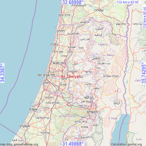
Az Zāwiyah GPS coordinates[2]
32° 5' 46.572" North, 35° 2' 23.352" East
| Map corner | latitude | longitude |
|---|---|---|
| Upper-left | 32.68998°, | 34.3367° |
| Center: | 32.09627°, | 35.03982° |
| Lower-right: | 31.49868°, | 35.74295° |
| Map W x H: | 132.5×132.5 km | = 82.3×82.3mi |
| max Lat: | 32.54346° ⇑43.3% North |
| Az Zāwiyah: | 32.09627° |
| min Lat: | ⇓56.7% South 31.25997° |
| min Long | Az Zāwiyah | max Long |
| 34.24357° | 35.03982° | 35.53898° |
| W 17.8%⇐ | ⇒82.2% E |
Elevation
Elevation of Az Zāwiyah is 250 m = 820 ft, and this is 223.3 m = 733 ft below average elevation for this country.
| Max E: |
999 m = 3278 ft | 78.6% |
| Avg. | 473.3 m = 1553 ft | |
| Az Zāwiyah | 250 m = 820 ft | |
Min E: |
-269 m = -883 ft | 21.4% |
See also: Palestinian Territory elevation on elevation.city.
Geographical zone
Az Zāwiyah is located in North temperate zone (between Tropic of Cancer and the Arctic Circle). Distance of this Northern Tropic circle is 962.9 km =598.3 mi to South.| Distance of | km | miles | from Az Zāwiyah |
|---|---|---|---|
| North Pole | 6438.3 | 4000.6 | to North |
| Arctic Circle | 3832.4 | 2381.3 | to North |
| Tropic Cancer | 962.9 | 598.3 | to South |
| Equator | 3568.8 | 2217.5 | to South |


Nearby cities:
15 places around Az Zāwiyah: (largest is in red/bold)
• Al Lubban al Gharbī
6.8 km =4.2 mi,  180°
180°
• Azun Atme
3.4 km =2.1 mi,  327°
327°
• Bayt Amīn
4.3 km =2.7 mi,  336°
336°
• Bidyā
4.3 km =2.7 mi,  61°
61°
• Brūqīn
6.2 km =3.9 mi,  115°
115°
• Dayr Ballūţ
3.7 km =2.3 mi,  202°
202°
• Kafr Thulth
6.4 km =4 mi,  6°
6°
• Kafr ad Dīk
5.2 km =3.2 mi,  128°
128°
• Masḩah
1.7 km =1.1 mi,  38°
38°
• Oranit
6.1 km =3.8 mi,  310°
310°
• Qarāwat Banī Ḩasan
6.6 km =4.1 mi, 60°
• Rāfāt
2.1 km =1.3 mi,  168°
168°
• Sannīryā
3.7 km =2.3 mi, 9°
• Şarţah
5 km =3.1 mi,  79°
79°
• ‘Izbat Salmān
6.4 km =4 mi,  322°
322°
Sources, notices
• [Note1] Compared only with cities in Palestinian Territory existing in our database
• [Src1] Map data: © OpenStreetMap contributors (CC-BY-SA)
• [Src2] Other city data from geonames.org with taken over terms of usage.
• [Src3] Geographical zone / Annual Mean Temperature by Robert A. Rohde @ Wikipedia
