‘Arabbūnah geodata
‘Arabbūnah (West Bank) is a populated place; located in Palestinian Territory in Asia/Hebron (GMT+3) time zone. With population of 800 people, there are 352 cities with bigger population in this country. Compared to other cities in Palestinian Territory, 99% of cities are located further ↓South; 93.6% of cities are located further ←West and 80.7% of cities have higher elevation than ‘Arabbūnah. Note1


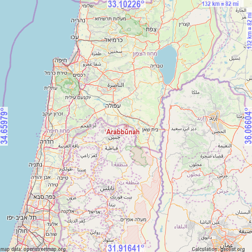
‘Arabbūnah GPS coordinates[2]
32° 30' 40.644" North, 35° 21' 46.476" East
| Map corner | latitude | longitude |
|---|---|---|
| Upper-left | 33.10226°, | 34.65979° |
| Center: | 32.51129°, | 35.36291° |
| Lower-right: | 31.91641°, | 36.06604° |
| Map W x H: | 131.9×131.9 km | = 82×82mi |
| max Lat: | 32.54346° ⇑1% North |
| ‘Arabbūnah: | 32.51129° |
| min Lat: | ⇓99% South 31.25997° |
| min Long | ‘Arabbūnah | max Long |
| 34.24357° | 35.36291° | 35.53898° |
| W 93.6%⇐ | ⇒6.4% E |
Elevation
Elevation of ‘Arabbūnah is 230 m = 755 ft, and this is 243.3 m = 798 ft below average elevation for this country.
| Max E: |
999 m = 3278 ft | 80.7% |
| Avg. | 473.3 m = 1553 ft | |
| ‘Arabbūnah | 230 m = 755 ft | |
Min E: |
-269 m = -883 ft | 19.3% |
See also: Palestinian Territory elevation on elevation.city.
Geographical zone
‘Arabbūnah is located in North temperate zone (between Tropic of Cancer and the Arctic Circle). Distance of this Northern Tropic circle is 1009 km =627 mi to South.| Distance of | km | miles | from ‘Arabbūnah |
|---|---|---|---|
| North Pole | 6392.1 | 3971.9 | to North |
| Arctic Circle | 3786.3 | 2352.7 | to North |
| Tropic Cancer | 1009 | 627 | to South |
| Equator | 3614.9 | 2246.2 | to South |


Nearby cities:
15 places around ‘Arabbūnah: (largest is in red/bold)
• Al Jalamah
4.7 km =2.9 mi,  265°
265°
• Al Mughayyir
10.1 km =6.3 mi,  168°
168°
• Ash Shuhadā’
12.5 km =7.8 mi,  223°
223°
• Bayt Qād
4.7 km =2.9 mi,  187°
187°
• Birqīn
11.5 km =7.1 mi,  236°
236°
• Dayr Abū Ḑa‘īf
6.1 km =3.8 mi,  181°
181°
• Dayr Ghazālah
2 km =1.2 mi,  212°
212°
• Faqqū‘ah
4.3 km =2.7 mi,  123°
123°
• Jalbūn
7.6 km =4.7 mi,  139°
139°
• Jalqamūs
9.6 km =6 mi, 179°
• Janīn
8.2 km =5.1 mi,  225°
225°
• Kafr Dān
10.8 km =6.7 mi,  250°
250°
• Sīlat al Ḩārithīyah
12.7 km =7.9 mi, 268°
• Umm at Tūt
9 km =5.6 mi, 191°
• ‘Arrānah
4.1 km =2.5 mi, 247°
Sources, notices
• [Note1] Compared only with cities in Palestinian Territory existing in our database
• [Src1] Map data: © OpenStreetMap contributors (CC-BY-SA)
• [Src2] Other city data from geonames.org with taken over terms of usage.
• [Src3] Geographical zone / Annual Mean Temperature by Robert A. Rohde @ Wikipedia
