Al Mughayyir geodata
Al Mughayyir (West Bank) is a populated place; located in Palestinian Territory in Asia/Hebron (GMT+3) time zone. With population of 2,328 people, there are 213 cities with bigger population in this country. Compared to other cities in Palestinian Territory, 50.1% of cities are located further ↑North; 92.6% of cities are located further ←West and 72.8% of cities have lower elevation than Al Mughayyir. Note1


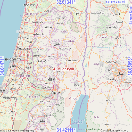
Al Mughayyir GPS coordinates[2]
32° 1' 9.12" North, 35° 20' 52.188" East
| Map corner | latitude | longitude |
|---|---|---|
| Upper-left | 32.61341°, | 34.64471° |
| Center: | 32.0192°, | 35.34783° |
| Lower-right: | 31.42111°, | 36.05096° |
| Map W x H: | 132.6×132.6 km | = 82.4×82.4mi |
| max Lat: | 32.54346° ⇑50.1% North |
| Al Mughayyir: | 32.0192° |
| min Lat: | ⇓49.9% South 31.25997° |
| min Long | Al Mughayyir | max Long |
| 34.24357° | 35.34783° | 35.53898° |
| W 92.6%⇐ | ⇒7.4% E |
Elevation
Elevation of Al Mughayyir is 673 m = 2208 ft, and this is 199.7 m = 655 ft above average elevation for this country.
| Max E: |
999 m = 3278 ft | 27.2% |
| Al Mughayyir | 673 m 2208 ft | |
| Avg. | 473.3 m = 1553 ft | |
Min E: |
-269 m = -883 ft | 72.8% |
See also: Palestinian Territory elevation on elevation.city.
Geographical zone
Al Mughayyir is located in North temperate zone (between Tropic of Cancer and the Arctic Circle). Distance of this Northern Tropic circle is 954.3 km =593 mi to South.| Distance of | km | miles | from Al Mughayyir |
|---|---|---|---|
| North Pole | 6446.9 | 4005.9 | to North |
| Arctic Circle | 3841 | 2386.7 | to North |
| Tropic Cancer | 954.3 | 593 | to South |
| Equator | 3560.2 | 2212.2 | to South |


Nearby cities:
15 places around Al Mughayyir: (largest is in red/bold)
• Al Faşāyil
9 km =5.6 mi,  85°
85°
• Al Mazra‘ah ash Sharqīyah
6.6 km =4.1 mi,  251°
251°
• Aţ Ţaybah
8.6 km =5.3 mi,  211°
211°
• Dayr Jarīr
7.9 km =4.9 mi,  221°
221°
• Domea
4.5 km =2.8 mi,  23°
23°
• Jūrīsh
9.5 km =5.9 mi,  345°
345°
• Kafr Mālik
5 km =3.1 mi,  226°
226°
• Khirbat Abū Falāḩ
4.4 km =2.7 mi,  266°
266°
• Majdal Banī Fāḑil
7.3 km =4.5 mi,  11°
11°
• Qaryūt
7.6 km =4.7 mi,  318°
318°
• Quşrah
7.6 km =4.7 mi, 347°
• Silwād
9.5 km =5.9 mi,  239°
239°
• Sinjil
7.9 km =4.9 mi,  281°
281°
• Talfīt
9.2 km =5.7 mi, 324°
• Turmus‘ayyā
6.1 km =3.8 mi,  287°
287°
Sources, notices
• [Note1] Compared only with cities in Palestinian Territory existing in our database
• [Src1] Map data: © OpenStreetMap contributors (CC-BY-SA)
• [Src2] Other city data from geonames.org with taken over terms of usage.
• [Src3] Geographical zone / Annual Mean Temperature by Robert A. Rohde @ Wikipedia
