Angra do Heroísmo geodata
Angra do Heroísmo (Azores) is a populated place; located in Portugal in Atlantic/Azores (GMT+0) time zone. With population of 12,045 people, there are 170 cities with bigger population in this country. Compared to other cities in Portugal, 77.4% of cities are located further ↑North; 97.3% of cities are located further →East and 99.9% of cities have higher elevation than Angra do Heroísmo. Note1
Administrative division(s):
- Level 1: Azores
- Level 2: Angra do Heroísmo
- Level 3: Angra (Nossa Senhora da Conceição)


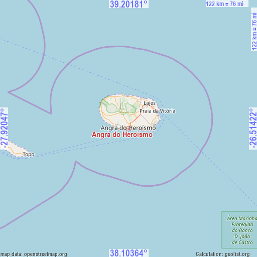
Angra do Heroísmo GPS coordinates[2]
38° 39' 17.388" North, 27° 13' 2.424" West
| Map corner | latitude | longitude |
|---|---|---|
| Upper-left | 39.20181°, | -27.92047° |
| Center: | 38.65483°, | -27.21734° |
| Lower-right: | 38.10364°, | -26.51422° |
| Map W x H: | 122.1×122.1 km | = 75.9×75.9mi |
| max Lat: | 42.11337° ⇑77.4% North |
| Angra do Heroísmo: | 38.65483° |
| min Lat: | ⇓22.6% South 32.6448° |
| min Long | Angra do Heroí | max Long |
| -31.17847° | -27.21734° | -6.27308° |
| W 2.7%⇐ | ⇒97.3% E |
Elevation
Elevation of Angra do Heroísmo is 1 m = 3 ft, and this is 176 m = 577 ft below average elevation for this country.
| Max E: |
1008 m = 3307 ft | 99.9% |
| Avg. | 177 m = 581 ft | |
| Angra do Heroísmo | 1 m = 3 ft | |
Min E: |
-128 m = -420 ft | 0.1% |
See also: Portugal elevation on elevation.city.
Geographical zone
Angra do Heroísmo is located in North temperate zone (between Tropic of Cancer and the Arctic Circle). Distance of this Northern Tropic circle is 1692.1 km =1051.4 mi to South.| Distance of | km | miles | from Angra do Heroísmo |
|---|---|---|---|
| North Pole | 5709 | 3547.4 | to North |
| Arctic Circle | 3103.2 | 1928.2 | to North |
| Tropic Cancer | 1692.1 | 1051.4 | to South |
| Equator | 4298 | 2670.7 | to South |


Nearby cities:
15 places around Angra do Heroísmo: (largest is in red/bold)
• Biscoitos
14.6 km =9.1 mi,  348°
348°
• Cabo da Praia
15.1 km =9.4 mi,  67°
67°
• Feteira
5.9 km =3.7 mi,  90°
90°
• Fonte Bastardo
12.7 km =7.9 mi, 70°
• Lajes
15.6 km =9.7 mi,  39°
39°
• Porto Judeu
8.5 km =5.3 mi,  95°
95°
• Porto Martins
14.1 km =8.8 mi,  77°
77°
• Praia da Vitória
15.7 km =9.8 mi,  56°
56°
• Ribeira Seca
66.8 km =41.5 mi,  264°
264°
• Ribeirinha
3.3 km =2.1 mi, 75°
• Santa Bárbara
11.5 km =7.1 mi,  293°
293°
• Santo Antão
52 km =32.3 mi, 257°
• São Bartolomeu
7 km =4.3 mi, 288°
• São Mateus
4.5 km =2.8 mi,  272°
272°
• São Sebastião
11.1 km =6.9 mi, 83°
Sources, notices
• [Note1] Compared only with cities in Portugal existing in our database
• [Src1] Map data: © OpenStreetMap contributors (CC-BY-SA)
• [Src2] Other city data from geonames.org with taken over terms of usage.
• [Src3] Geographical zone / Annual Mean Temperature by Robert A. Rohde @ Wikipedia
