Al Jumaylīyah geodata
Al Jumaylīyah (Al-Shahaniya) is a populated place; located in Qatar in Asia/Qatar (GMT+3) time zone. With population of 1,788 people, there are 13 cities with bigger population in this country. Compared to other cities in Qatar, 70.6% of cities are located further ↓South; 82.4% of cities are located further →East and 82.4% of cities have lower elevation than Al Jumaylīyah. Note1


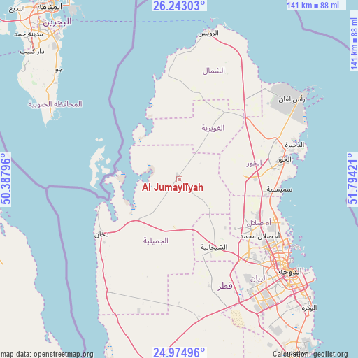
Al Jumaylīyah GPS coordinates[2]
25° 36' 38.448" North, 51° 5' 27.888" East
| Map corner | latitude | longitude |
|---|---|---|
| Upper-left | 26.24303°, | 50.38796° |
| Center: | 25.61068°, | 51.09108° |
| Lower-right: | 24.97496°, | 51.79421° |
| Map W x H: | 141×141 km | = 87.6×87.6mi |
| max Lat: | 26.13978° ⇑29.4% North |
| Al Jumaylīyah: | 25.61068° |
| min Lat: | ⇓70.6% South 24.7437° |
| min Long | Al Jumaylīyah | max Long |
| 50.78227° | 51.09108° | 51.60337° |
| W 17.6%⇐ | ⇒82.4% E |
Elevation
Elevation of Al Jumaylīyah is 28 m = 92 ft, and this is 10.2 m = 33 ft above average elevation for this country.
| Max E: |
56 m = 184 ft | 17.6% |
| Al Jumaylīyah | 28 m 92 ft | |
| Avg. | 17.8 m = 58 ft | |
Min E: |
4 m = 13 ft | 82.4% |
See also: Qatar elevation on elevation.city.
Geographical zone
Al Jumaylīyah is located in North temperate zone (between Tropic of Cancer and the Arctic Circle). Distance of this Northern Tropic circle is 241.7 km =150.2 mi to South.| Distance of | km | miles | from Al Jumaylīyah |
|---|---|---|---|
| North Pole | 7159.4 | 4448.6 | to North |
| Arctic Circle | 4553.5 | 2829.4 | to North |
| Tropic Cancer | 241.7 | 150.2 | to South |
| Equator | 2847.6 | 1769.4 | to South |


Nearby cities:
15 places around Al Jumaylīyah: (largest is in red/bold)
• Al Ghuwayrīyah
28.8 km =17.9 mi,  32°
32°
• Al Khawr
42.4 km =26.3 mi,  78°
78°
• Al Wakrah
70.9 km =44.1 mi,  133°
133°
• Al Wukayr
68 km =42.3 mi,  138°
138°
• Ar Rayyān
48.7 km =30.3 mi, 136°
• Ar Ruways
60.1 km =37.3 mi,  11°
11°
• Ash Shīḩānīyah
29.8 km =18.5 mi,  153°
153°
• Az̧ Z̧a‘āyin
39.5 km =24.5 mi,  95°
95°
• Doha
57.1 km =35.5 mi, 129°
• Dukhān
37.2 km =23.1 mi,  236°
236°
• Fuwayriţ
53.9 km =33.5 mi, 31°
• Madīnat ash Shamāl
58.7 km =36.5 mi, 10°
• Umm Bāb
52.5 km =32.6 mi,  212°
212°
• Umm Şalāl Muḩammad
38.4 km =23.9 mi,  124°
124°
• Umm Şalāl ‘Alī
34.5 km =21.4 mi, 117°
Sources, notices
• [Note1] Compared only with cities in Qatar existing in our database
• [Src1] Map data: © OpenStreetMap contributors (CC-BY-SA)
• [Src2] Other city data from geonames.org with taken over terms of usage.
• [Src3] Geographical zone / Annual Mean Temperature by Robert A. Rohde @ Wikipedia
