Fuwayriţ geodata
Fuwayriţ (Madīnat ash Shamāl) is a populated place; located in Qatar in Asia/Qatar (GMT+3) time zone. With population of 1,333 people, there are 14 cities with bigger population in this country. Compared to other cities in Qatar, 88.2% of cities are located further ↓South; 52.9% of cities are located further →East and 100% of cities have higher elevation than Fuwayriţ. Note1


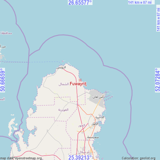
Fuwayriţ GPS coordinates[2]
26° 1' 32.34" North, 51° 22' 10.956" East
| Map corner | latitude | longitude |
|---|---|---|
| Upper-left | 26.65577°, | 50.66659° |
| Center: | 26.02565°, | 51.36971° |
| Lower-right: | 25.39213°, | 52.07284° |
| Map W x H: | 140.5×140.5 km | = 87.3×87.3mi |
| max Lat: | 26.13978° ⇑11.8% North |
| Fuwayriţ: | 26.02565° |
| min Lat: | ⇓88.2% South 24.7437° |
| min Long | Fuwayriţ | max Long |
| 50.78227° | 51.36971° | 51.60337° |
| W 47.1%⇐ | ⇒52.9% E |
Elevation
Elevation of Fuwayriţ is 4 m = 13 ft, and this is 13.8 m = 45 ft below average elevation for this country.
| Max E: |
56 m = 184 ft | 100% |
| Avg. | 17.8 m = 58 ft | |
| Fuwayriţ | 4 m = 13 ft | |
Min E: |
4 m = 13 ft | 0% |
See also: Qatar elevation on elevation.city.
Geographical zone
Fuwayriţ is located in North temperate zone (between Tropic of Cancer and the Arctic Circle). Distance of this Northern Tropic circle is 287.9 km =178.9 mi to South.| Distance of | km | miles | from Fuwayriţ |
|---|---|---|---|
| North Pole | 7113.3 | 4420 | to North |
| Arctic Circle | 4507.4 | 2800.8 | to North |
| Tropic Cancer | 287.9 | 178.9 | to South |
| Equator | 2893.8 | 1798.1 | to South |


Nearby cities:
15 places around Fuwayriţ: (largest is in red/bold)
• Al Ghuwayrīyah
25.2 km =15.7 mi,  209°
209°
• Al Jumaylīyah
53.9 km =33.5 mi, 211°
• Al Khawr
40.4 km =25.1 mi,  160°
160°
• Al Wakrah
97.8 km =60.8 mi,  166°
166°
• Al Wukayr
98.7 km =61.3 mi, 170°
• Ar Rayyān
81.8 km =50.8 mi,  176°
176°
• Ar Ruways
20 km =12.4 mi,  309°
309°
• Ash Shīḩānīyah
74.3 km =46.2 mi,  191°
191°
• Az̧ Z̧a‘āyin
51.1 km =31.8 mi, 167°
• Doha
83.9 km =52.1 mi, 168°
• Dukhān
89 km =55.3 mi,  221°
221°
• Madīnat ash Shamāl
20.4 km =12.7 mi,  304°
304°
• Umm Bāb
106.4 km =66.1 mi, 212°
• Umm Şalāl Muḩammad
68 km =42.3 mi, 176°
• Umm Şalāl ‘Alī
61.9 km =38.5 mi, 177°
Sources, notices
• [Note1] Compared only with cities in Qatar existing in our database
• [Src1] Map data: © OpenStreetMap contributors (CC-BY-SA)
• [Src2] Other city data from geonames.org with taken over terms of usage.
• [Src3] Geographical zone / Annual Mean Temperature by Robert A. Rohde @ Wikipedia
