Plopeni geodata
Plopeni (Prahova) is a populated place; located in Romania in Europe/Bucharest (GMT+3) time zone. With population of 1,590 people, there are 3059 cities with bigger population in this country. Compared to other cities in Romania, 67.1% of cities are located further ↑North; 62.5% of cities are located further ←West and 53.3% of cities have lower elevation than Plopeni. Note1


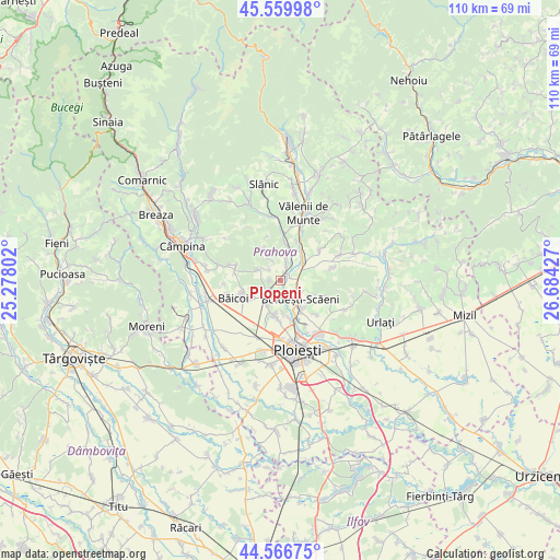
Plopeni GPS coordinates[2]
45° 3' 55.872" North, 25° 58' 52.104" East
| Map corner | latitude | longitude |
|---|---|---|
| Upper-left | 45.55998°, | 25.27802° |
| Center: | 45.06552°, | 25.98114° |
| Lower-right: | 44.56675°, | 26.68427° |
| Map W x H: | 110.4×110.4 km | = 68.6×68.6mi |
| max Lat: | 48.23793° ⇑67.1% North |
| Plopeni: | 45.06552° |
| min Lat: | ⇓32.9% South 43.65638° |
| min Long | Plopeni | max Long |
| 20.31667° | 25.98114° | 29.65403° |
| W 62.5%⇐ | ⇒37.5% E |
Elevation
Elevation of Plopeni is 229 m = 751 ft, and this is 25.9 m = 85 ft below average elevation for this country.
| Max E: |
1278 m = 4193 ft | 46.7% |
| Avg. | 254.9 m = 836 ft | |
| Plopeni | 229 m = 751 ft | |
Min E: |
-2 m = -7 ft | 53.3% |
See also: Romania elevation on elevation.city.
Geographical zone
Plopeni is located in North temperate zone (between Tropic of Cancer and the Arctic Circle). Distance of this North polar circle is 2390.4 km =1485.3 mi to North.| Distance of | km | miles | from Plopeni |
|---|---|---|---|
| North Pole | 4996.2 | 3104.5 | to North |
| Arctic Circle | 2390.4 | 1485.3 | to North |
| Tropic Cancer | 2404.9 | 1494.3 | to South |
| Equator | 5010.8 | 3113.6 | to South |


Nearby cities:
15 places around Plopeni: (largest is in red/bold)
• Boldeşti-Scăeni
5.4 km =3.4 mi,  131°
131°
• Cocorăștii Mislii
5.1 km =3.2 mi,  295°
295°
• Cocoșești
6.5 km =4 mi,  178°
178°
• Cârjari
5.2 km =3.2 mi,  332°
332°
• Dumbrăveşti
2.5 km =1.6 mi,  36°
36°
• Goruna
3.9 km =2.4 mi,  307°
307°
• Găgeni
5.6 km =3.5 mi,  209°
209°
• Iazu
3.5 km =2.2 mi,  59°
59°
• Lipăneşti
3.3 km =2.1 mi,  121°
121°
• Măgurele
5.6 km =3.5 mi,  46°
46°
• Mălăeștii de Jos
4.5 km =2.8 mi,  16°
16°
• Plopeni
2.9 km =1.8 mi,  232°
232°
• Zamfira
2.2 km =1.4 mi,  81°
81°
• Șipotu
3.9 km =2.4 mi, 134°
• Țipărești
3 km =1.9 mi,  318°
318°
Sources, notices
• [Note1] Compared only with cities in Romania existing in our database
• [Src1] Map data: © OpenStreetMap contributors (CC-BY-SA)
• [Src2] Other city data from geonames.org with taken over terms of usage.
• [Src3] Geographical zone / Annual Mean Temperature by Robert A. Rohde @ Wikipedia
