Voivozi geodata
Voivozi (Bihor) is a populated place; located in Romania in Europe/Bucharest (GMT+3) time zone. With population of 1,991 people, there are 2607 cities with bigger population in this country. Compared to other cities in Romania, 84.3% of cities are located further ↓South; 90.8% of cities are located further →East and 54.4% of cities have higher elevation than Voivozi. Note1


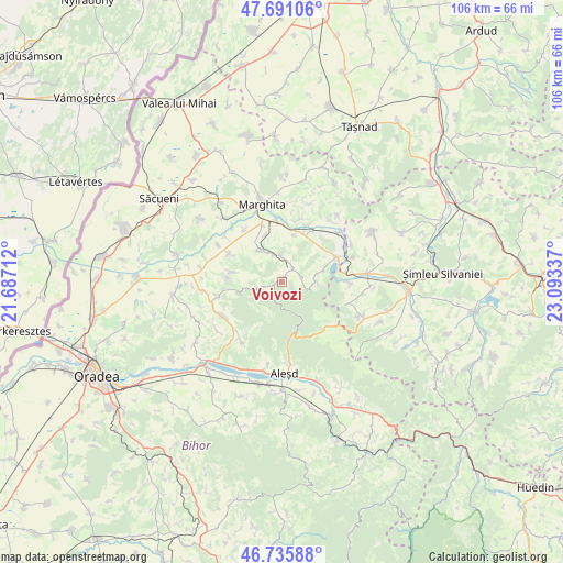
Voivozi GPS coordinates[2]
47° 12' 56.232" North, 22° 23' 24.864" East
| Map corner | latitude | longitude |
|---|---|---|
| Upper-left | 47.69106°, | 21.68712° |
| Center: | 47.21562°, | 22.39024° |
| Lower-right: | 46.73588°, | 23.09337° |
| Map W x H: | 106.2×106.2 km | = 66×66mi |
| max Lat: | 48.23793° ⇑15.7% North |
| Voivozi: | 47.21562° |
| min Lat: | ⇓84.3% South 43.65638° |
| min Long | Voivozi | max Long |
| 20.31667° | 22.39024° | 29.65403° |
| W 9.2%⇐ | ⇒90.8% E |
Elevation
Elevation of Voivozi is 190 m = 623 ft, and this is 64.9 m = 213 ft below average elevation for this country.
| Max E: |
1278 m = 4193 ft | 54.4% |
| Avg. | 254.9 m = 836 ft | |
| Voivozi | 190 m = 623 ft | |
Min E: |
-2 m = -7 ft | 45.6% |
See also: Romania elevation on elevation.city.
Geographical zone
Voivozi is located in North temperate zone (between Tropic of Cancer and the Arctic Circle). Distance of this North polar circle is 2151.3 km =1336.8 mi to North.| Distance of | km | miles | from Voivozi |
|---|---|---|---|
| North Pole | 4757.2 | 2956 | to North |
| Arctic Circle | 2151.3 | 1336.8 | to North |
| Tropic Cancer | 2644 | 1642.9 | to South |
| Equator | 5249.9 | 3262.1 | to South |


Nearby cities:
15 places around Voivozi: (largest is in red/bold)
• Bistra
5 km =3.1 mi,  29°
29°
• Bogei
6 km =3.7 mi,  338°
338°
• Borumlaca
6.7 km =4.2 mi,  89°
89°
• Ciutelec
5.2 km =3.2 mi,  357°
357°
• Cuzap
2.4 km =1.5 mi,  126°
126°
• Derna
7 km =4.3 mi,  255°
255°
• Dernișoara
10.4 km =6.5 mi,  273°
273°
• Margine
9.2 km =5.7 mi,  16°
16°
• Popeşti
2.8 km =1.7 mi,  45°
45°
• Pădurea Neagră
5.8 km =3.6 mi,  162°
162°
• Sacalasău
8.1 km =5 mi, 255°
• Tria
9.6 km =6 mi,  281°
281°
• Tăuteu
7.1 km =4.4 mi,  322°
322°
• Varviz
3.8 km =2.4 mi,  74°
74°
• Şinteu
10.1 km =6.3 mi,  136°
136°
Sources, notices
• [Note1] Compared only with cities in Romania existing in our database
• [Src1] Map data: © OpenStreetMap contributors (CC-BY-SA)
• [Src2] Other city data from geonames.org with taken over terms of usage.
• [Src3] Geographical zone / Annual Mean Temperature by Robert A. Rohde @ Wikipedia
