Voitinel geodata
Voitinel (Suceava) is a seat of a second-order administrative division; located in Romania in Europe/Bucharest (GMT+3) time zone. With population of 3,159 people, there are 1649 cities with bigger population in this country. Compared to other cities in Romania, 97.8% of cities are located further ↓South; 58.3% of cities are located further ←West and 85.7% of cities have lower elevation than Voitinel. Note1


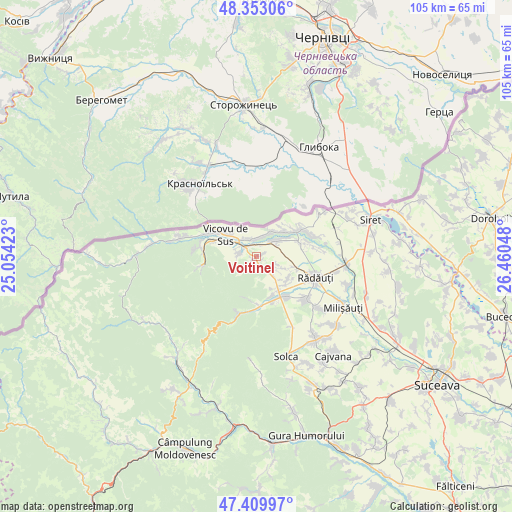
Voitinel GPS coordinates[2]
47° 53' 1.176" North, 25° 45' 26.46" East
| Map corner | latitude | longitude |
|---|---|---|
| Upper-left | 48.35306°, | 25.05423° |
| Center: | 47.88366°, | 25.75735° |
| Lower-right: | 47.40997°, | 26.46048° |
| Map W x H: | 104.9×104.9 km | = 65.2×65.2mi |
| max Lat: | 48.23793° ⇑2.2% North |
| Voitinel: | 47.88366° |
| min Lat: | ⇓97.8% South 43.65638° |
| min Long | Voitinel | max Long |
| 20.31667° | 25.75735° | 29.65403° |
| W 58.3%⇐ | ⇒41.7% E |
Elevation
Elevation of Voitinel is 454 m = 1490 ft, and this is 199.1 m = 653 ft above average elevation for this country.
| Max E: |
1278 m = 4193 ft | 14.3% |
| Voitinel | 454 m 1490 ft | |
| Avg. | 254.9 m = 836 ft | |
Min E: |
-2 m = -7 ft | 85.7% |
See also: Romania elevation on elevation.city.
Geographical zone
Voitinel is located in North temperate zone (between Tropic of Cancer and the Arctic Circle). Distance of this North polar circle is 2077 km =1290.6 mi to North.| Distance of | km | miles | from Voitinel |
|---|---|---|---|
| North Pole | 4682.9 | 2909.8 | to North |
| Arctic Circle | 2077 | 1290.6 | to North |
| Tropic Cancer | 2718.2 | 1689 | to South |
| Equator | 5324.2 | 3308.3 | to South |


Nearby cities:
15 places around Voitinel: (largest is in red/bold)
• Bilca
3.7 km =2.3 mi,  351°
351°
• Bivolărie
8.4 km =5.2 mi,  294°
294°
• Frătăuţii Noi
9.2 km =5.7 mi,  44°
44°
• Frătăuţii Vechi
9.6 km =6 mi,  79°
79°
• Gura Putnei
12.2 km =7.6 mi,  278°
278°
• Gălăneşti
4.9 km =3 mi, 40°
• Horodnic de Jos
5 km =3.1 mi,  114°
114°
• Horodnic de Sus
6.9 km =4.3 mi,  134°
134°
• Hurjuieni
5.7 km =3.5 mi,  50°
50°
• Marginea
8.7 km =5.4 mi,  149°
149°
• Putna
10.7 km =6.6 mi,  259°
259°
• Suceviţa
11.6 km =7.2 mi,  195°
195°
• Vicovu de Jos
2.6 km =1.6 mi,  315°
315°
• Vicovu de Sus
7.8 km =4.8 mi, 315°
• Voievodeasa
9.4 km =5.8 mi,  183°
183°
Sources, notices
• [Note1] Compared only with cities in Romania existing in our database
• [Src1] Map data: © OpenStreetMap contributors (CC-BY-SA)
• [Src2] Other city data from geonames.org with taken over terms of usage.
• [Src3] Geographical zone / Annual Mean Temperature by Robert A. Rohde @ Wikipedia
