Voievodeasa geodata
Voievodeasa (Suceava) is a populated place; located in Romania in Europe/Bucharest (GMT+3) time zone. With population of 1,208 people, there are 3722 cities with bigger population in this country. Compared to other cities in Romania, 96.6% of cities are located further ↓South; 58.1% of cities are located further ←West and 90% of cities have lower elevation than Voievodeasa. Note1


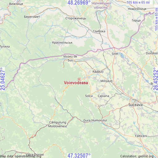
Voievodeasa GPS coordinates[2]
47° 47' 58.308" North, 25° 44' 57.804" East
| Map corner | latitude | longitude |
|---|---|---|
| Upper-left | 48.26969°, | 25.04627° |
| Center: | 47.79953°, | 25.74939° |
| Lower-right: | 47.32507°, | 26.45252° |
| Map W x H: | 105×105 km | = 65.2×65.2mi |
| max Lat: | 48.23793° ⇑3.4% North |
| Voievodeasa: | 47.79953° |
| min Lat: | ⇓96.6% South 43.65638° |
| min Long | Voievodeasa | max Long |
| 20.31667° | 25.74939° | 29.65403° |
| W 58.1%⇐ | ⇒41.9% E |
Elevation
Elevation of Voievodeasa is 512 m = 1680 ft, and this is 257.1 m = 844 ft above average elevation for this country.
| Max E: |
1278 m = 4193 ft | 10% |
| Voievodeasa | 512 m 1680 ft | |
| Avg. | 254.9 m = 836 ft | |
Min E: |
-2 m = -7 ft | 90% |
See also: Romania elevation on elevation.city.
Geographical zone
Voievodeasa is located in North temperate zone (between Tropic of Cancer and the Arctic Circle). Distance of this North polar circle is 2086.4 km =1296.4 mi to North.| Distance of | km | miles | from Voievodeasa |
|---|---|---|---|
| North Pole | 4692.3 | 2915.7 | to North |
| Arctic Circle | 2086.4 | 1296.4 | to North |
| Tropic Cancer | 2708.9 | 1683.2 | to South |
| Equator | 5314.8 | 3302.5 | to South |


Nearby cities:
15 places around Voievodeasa: (largest is in red/bold)
• Bilca
13 km =8.1 mi,  0°
0°
• Burla
13.3 km =8.3 mi,  94°
94°
• Clit
9.5 km =5.9 mi,  122°
122°
• Gălăneşti
13.6 km =8.5 mi,  16°
16°
• Horodnic de Jos
8.9 km =5.5 mi,  35°
35°
• Horodnic de Sus
7.1 km =4.4 mi,  50°
50°
• Hurjuieni
14 km =8.7 mi, 21°
• Marginea
5.4 km =3.4 mi,  69°
69°
• Putna
12.4 km =7.7 mi,  307°
307°
• Rădăuți
13.7 km =8.5 mi, 65°
• Solca
13.4 km =8.3 mi,  145°
145°
• Suceviţa
3 km =1.9 mi,  233°
233°
• Vicovu de Jos
11.2 km =7 mi,  353°
353°
• Voitinel
9.4 km =5.8 mi, 3°
• Volovăţ
11.4 km =7.1 mi,  80°
80°
Sources, notices
• [Note1] Compared only with cities in Romania existing in our database
• [Src1] Map data: © OpenStreetMap contributors (CC-BY-SA)
• [Src2] Other city data from geonames.org with taken over terms of usage.
• [Src3] Geographical zone / Annual Mean Temperature by Robert A. Rohde @ Wikipedia
