Vârlezi geodata
Vârlezi (Galaţi) is a seat of a second-order administrative division; located in Romania in Europe/Bucharest (GMT+3) time zone. With population of 2,185 people, there are 2439 cities with bigger population in this country. Compared to other cities in Romania, 52.6% of cities are located further ↓South; 94.8% of cities are located further ←West and 69.3% of cities have higher elevation than Vârlezi. Note1


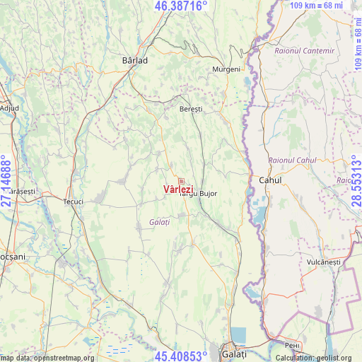
Vârlezi GPS coordinates[2]
45° 54' 0" North, 27° 51' 0" East
| Map corner | latitude | longitude |
|---|---|---|
| Upper-left | 46.38716°, | 27.14688° |
| Center: | 45.9°, | 27.85° |
| Lower-right: | 45.40853°, | 28.55313° |
| Map W x H: | 108.8×108.8 km | = 67.6×67.6mi |
| max Lat: | 48.23793° ⇑47.4% North |
| Vârlezi: | 45.9° |
| min Lat: | ⇓52.6% South 43.65638° |
| min Long | Vârlezi | max Long |
| 20.31667° | 27.85° | 29.65403° |
| W 94.8%⇐ | ⇒5.2% E |
Elevation
Elevation of Vârlezi is 130 m = 427 ft, and this is 124.9 m = 410 ft below average elevation for this country.
| Max E: |
1278 m = 4193 ft | 69.3% |
| Avg. | 254.9 m = 836 ft | |
| Vârlezi | 130 m = 427 ft | |
Min E: |
-2 m = -7 ft | 30.7% |
See also: Romania elevation on elevation.city.
Geographical zone
Vârlezi is located in North temperate zone (between Tropic of Cancer and the Arctic Circle). Distance of this North polar circle is 2297.6 km =1427.7 mi to North.| Distance of | km | miles | from Vârlezi |
|---|---|---|---|
| North Pole | 4903.5 | 3046.9 | to North |
| Arctic Circle | 2297.6 | 1427.7 | to North |
| Tropic Cancer | 2497.7 | 1552 | to South |
| Equator | 5103.6 | 3171.2 | to South |


Nearby cities:
15 places around Vârlezi: (largest is in red/bold)
• Băleni
9.4 km =5.8 mi,  187°
187°
• Băneasa
7.4 km =4.6 mi,  60°
60°
• Corni
8.5 km =5.3 mi,  229°
229°
• Crăiești
5.7 km =3.5 mi,  328°
328°
• Drăguşeni
10.7 km =6.6 mi,  313°
313°
• Fundeanu
13.1 km =8.1 mi,  316°
316°
• Jorăşti
9.4 km =5.8 mi,  7°
7°
• Moscu
6.3 km =3.9 mi,  87°
87°
• Mândrești
11.8 km =7.3 mi,  260°
260°
• Măcișeni
8.9 km =5.5 mi,  236°
236°
• Smulţi
8.6 km =5.3 mi,  295°
295°
• Târgu Bujor
5.4 km =3.4 mi,  133°
133°
• Umbrărești
7.8 km =4.8 mi,  137°
137°
• Urlești
4.5 km =2.8 mi, 261°
• Viile
12.8 km =8 mi, 143°
Sources, notices
• [Note1] Compared only with cities in Romania existing in our database
• [Src1] Map data: © OpenStreetMap contributors (CC-BY-SA)
• [Src2] Other city data from geonames.org with taken over terms of usage.
• [Src3] Geographical zone / Annual Mean Temperature by Robert A. Rohde @ Wikipedia
