Vintilă Vodă geodata
Vintilă Vodă (Buzău) is a seat of a second-order administrative division; located in Romania in Europe/Bucharest (GMT+3) time zone. With population of 3,367 people, there are 1512 cities with bigger population in this country. Compared to other cities in Romania, 55.9% of cities are located further ↑North; 76.9% of cities are located further ←West and 84.4% of cities have lower elevation than Vintilă Vodă. Note1


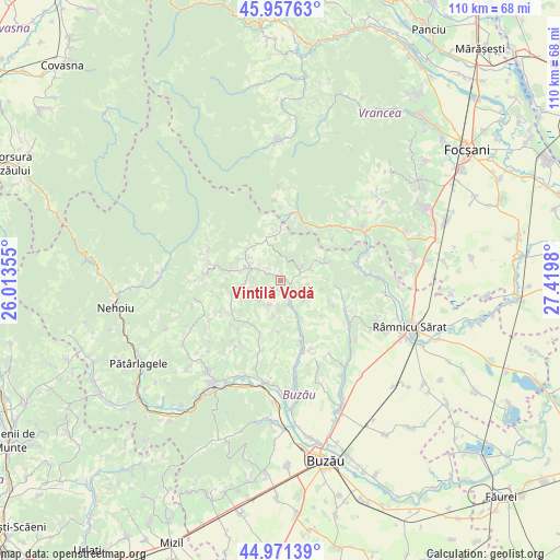
Vintilă Vodă GPS coordinates[2]
45° 28' 0.012" North, 26° 43' 0.012" East
| Map corner | latitude | longitude |
|---|---|---|
| Upper-left | 45.95763°, | 26.01355° |
| Center: | 45.46667°, | 26.71667° |
| Lower-right: | 44.97139°, | 27.4198° |
| Map W x H: | 109.7×109.7 km | = 68.2×68.2mi |
| max Lat: | 48.23793° ⇑55.9% North |
| Vintilă Vodă: | 45.46667° |
| min Lat: | ⇓44.1% South 43.65638° |
| min Long | Vintilă Vodă | max Long |
| 20.31667° | 26.71667° | 29.65403° |
| W 76.9%⇐ | ⇒23.1% E |
Elevation
Elevation of Vintilă Vodă is 439 m = 1440 ft, and this is 184.1 m = 604 ft above average elevation for this country.
| Max E: |
1278 m = 4193 ft | 15.6% |
| Vintilă Vodă | 439 m 1440 ft | |
| Avg. | 254.9 m = 836 ft | |
Min E: |
-2 m = -7 ft | 84.4% |
See also: Romania elevation on elevation.city.
Geographical zone
Vintilă Vodă is located in North temperate zone (between Tropic of Cancer and the Arctic Circle). Distance of this North polar circle is 2345.8 km =1457.6 mi to North.| Distance of | km | miles | from Vintilă Vodă |
|---|---|---|---|
| North Pole | 4951.6 | 3076.8 | to North |
| Arctic Circle | 2345.8 | 1457.6 | to North |
| Tropic Cancer | 2449.5 | 1522 | to South |
| Equator | 5055.4 | 3141.3 | to South |


Nearby cities:
15 places around Vintilă Vodă: (largest is in red/bold)
• Beceni
10.6 km =6.6 mi,  150°
150°
• Bisoca
7.5 km =4.7 mi,  350°
350°
• Chiliile
10.6 km =6.6 mi,  259°
259°
• Căneşti
11.7 km =7.3 mi,  230°
230°
• Grunji
6.4 km =4 mi,  305°
305°
• Gura Dimienii
7.7 km =4.8 mi, 154°
• Hârja
8.6 km =5.3 mi,  64°
64°
• Lopătari
10.6 km =6.6 mi,  280°
280°
• Mânzăleşti
6.4 km =4 mi, 305°
• Mărgăriteşti
9.8 km =6.1 mi,  112°
112°
• Niculești
3.9 km =2.4 mi, 149°
• Scorţoasa
12.2 km =7.6 mi,  200°
200°
• Sările
7.8 km =4.8 mi,  19°
19°
• Săruleşti
4.5 km =2.8 mi,  35°
35°
• Valea Salciei
9 km =5.6 mi,  68°
68°
Sources, notices
• [Note1] Compared only with cities in Romania existing in our database
• [Src1] Map data: © OpenStreetMap contributors (CC-BY-SA)
• [Src2] Other city data from geonames.org with taken over terms of usage.
• [Src3] Geographical zone / Annual Mean Temperature by Robert A. Rohde @ Wikipedia
