Vaida geodata
Vaida (Bihor) is a populated place; located in Romania in Europe/Bucharest (GMT+3) time zone. With population of 598 people, there are 6220 cities with bigger population in this country. Compared to other cities in Romania, 85.5% of cities are located further ↓South; 94.5% of cities are located further →East and 68.4% of cities have higher elevation than Vaida. Note1


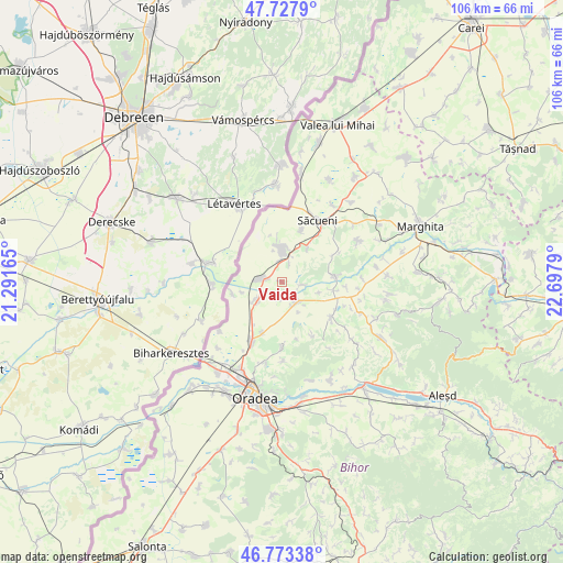
Vaida GPS coordinates[2]
47° 15' 10.044" North, 21° 59' 41.172" East
| Map corner | latitude | longitude |
|---|---|---|
| Upper-left | 47.7279°, | 21.29165° |
| Center: | 47.25279°, | 21.99477° |
| Lower-right: | 46.77338°, | 22.6979° |
| Map W x H: | 106.1×106.1 km | = 65.9×65.9mi |
| max Lat: | 48.23793° ⇑14.5% North |
| Vaida: | 47.25279° |
| min Lat: | ⇓85.5% South 43.65638° |
| min Long | Vaida | max Long |
| 20.31667° | 21.99477° | 29.65403° |
| W 5.5%⇐ | ⇒94.5% E |
Elevation
Elevation of Vaida is 133 m = 436 ft, and this is 121.9 m = 400 ft below average elevation for this country.
| Max E: |
1278 m = 4193 ft | 68.4% |
| Avg. | 254.9 m = 836 ft | |
| Vaida | 133 m = 436 ft | |
Min E: |
-2 m = -7 ft | 31.6% |
See also: Romania elevation on elevation.city.
Geographical zone
Vaida is located in North temperate zone (between Tropic of Cancer and the Arctic Circle). Distance of this North polar circle is 2147.2 km =1334.2 mi to North.| Distance of | km | miles | from Vaida |
|---|---|---|---|
| North Pole | 4753 | 2953.4 | to North |
| Arctic Circle | 2147.2 | 1334.2 | to North |
| Tropic Cancer | 2648.1 | 1645.5 | to South |
| Equator | 5254 | 3264.7 | to South |


Nearby cities:
15 places around Vaida: (largest is in red/bold)
• Cadea
8.3 km =5.2 mi,  37°
37°
• Cauaceu
10.3 km =6.4 mi,  201°
201°
• Ciocaia
10.3 km =6.4 mi,  21°
21°
• Diosig
5.3 km =3.3 mi,  4°
4°
• Hodoș
3.2 km =2 mi,  193°
193°
• Mihai Bravu
4.3 km =2.7 mi,  277°
277°
• Parhida
9.5 km =5.9 mi,  257°
257°
• Roșiori
3.3 km =2.1 mi, 277°
• Sâniob
10.1 km =6.3 mi,  82°
82°
• Sânnicolau de Munte
12.1 km =7.5 mi,  62°
62°
• Sântimreu
3.8 km =2.4 mi,  96°
96°
• Sârbi
11.7 km =7.3 mi,  124°
124°
• Sălard
5.8 km =3.6 mi,  133°
133°
• Tămășeu
6.2 km =3.9 mi,  235°
235°
• Șișterea
11.9 km =7.4 mi,  149°
149°
Sources, notices
• [Note1] Compared only with cities in Romania existing in our database
• [Src1] Map data: © OpenStreetMap contributors (CC-BY-SA)
• [Src2] Other city data from geonames.org with taken over terms of usage.
• [Src3] Geographical zone / Annual Mean Temperature by Robert A. Rohde @ Wikipedia
