Tungujei geodata
Tungujei (Iaşi) is a populated place; located in Romania in Europe/Bucharest (GMT+3) time zone. With population of 648 people, there are 5891 cities with bigger population in this country. Compared to other cities in Romania, 77.1% of cities are located further ↓South; 89.2% of cities are located further ←West and 50.7% of cities have lower elevation than Tungujei. Note1


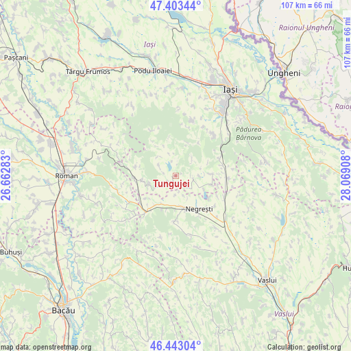
Tungujei GPS coordinates[2]
46° 55' 31.404" North, 27° 21' 57.42" East
| Map corner | latitude | longitude |
|---|---|---|
| Upper-left | 47.40344°, | 26.66283° |
| Center: | 46.92539°, | 27.36595° |
| Lower-right: | 46.44304°, | 28.06908° |
| Map W x H: | 106.8×106.8 km | = 66.4×66.4mi |
| max Lat: | 48.23793° ⇑22.9% North |
| Tungujei: | 46.92539° |
| min Lat: | ⇓77.1% South 43.65638° |
| min Long | Tungujei | max Long |
| 20.31667° | 27.36595° | 29.65403° |
| W 89.2%⇐ | ⇒10.8% E |
Elevation
Elevation of Tungujei is 215 m = 705 ft, and this is 39.9 m = 131 ft below average elevation for this country.
| Max E: |
1278 m = 4193 ft | 49.3% |
| Avg. | 254.9 m = 836 ft | |
| Tungujei | 215 m = 705 ft | |
Min E: |
-2 m = -7 ft | 50.7% |
See also: Romania elevation on elevation.city.
Geographical zone
Tungujei is located in North temperate zone (between Tropic of Cancer and the Arctic Circle). Distance of this North polar circle is 2183.6 km =1356.8 mi to North.| Distance of | km | miles | from Tungujei |
|---|---|---|---|
| North Pole | 4789.4 | 2976 | to North |
| Arctic Circle | 2183.6 | 1356.8 | to North |
| Tropic Cancer | 2611.7 | 1622.8 | to South |
| Equator | 5217.6 | 3242.1 | to South |


Nearby cities:
15 places around Tungujei: (largest is in red/bold)
• Alexeni
5 km =3.1 mi,  2°
2°
• Bâcu
7.1 km =4.4 mi,  91°
91°
• Dumeşti
10.5 km =6.5 mi,  216°
216°
• Frenciugi
9.4 km =5.8 mi,  116°
116°
• Glodenii Gândului
5.8 km =3.6 mi,  299°
299°
• Gârbești
8.2 km =5.1 mi,  322°
322°
• Ipatele
4 km =2.5 mi,  104°
104°
• Jigoreni
5.1 km =3.2 mi,  230°
230°
• Mironeasa
6 km =3.7 mi,  39°
39°
• Răsboieni
3.8 km =2.4 mi,  280°
280°
• Suhuleț
8.5 km =5.3 mi,  253°
253°
• Tansa
10.1 km =6.3 mi,  264°
264°
• Todireşti
8.4 km =5.2 mi,  179°
179°
• Ţibana
6.9 km =4.3 mi,  338°
338°
• Ţibăneşti
2.7 km =1.7 mi, 248°
Sources, notices
• [Note1] Compared only with cities in Romania existing in our database
• [Src1] Map data: © OpenStreetMap contributors (CC-BY-SA)
• [Src2] Other city data from geonames.org with taken over terms of usage.
• [Src3] Geographical zone / Annual Mean Temperature by Robert A. Rohde @ Wikipedia
