Tansa geodata
Tansa (Iaşi) is a seat of a second-order administrative division; located in Romania in Europe/Bucharest (GMT+3) time zone. With population of 3,081 people, there are 1710 cities with bigger population in this country. Compared to other cities in Romania, 76.7% of cities are located further ↓South; 87.3% of cities are located further ←West and 69.8% of cities have lower elevation than Tansa. Note1


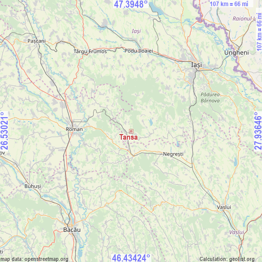
Tansa GPS coordinates[2]
46° 55' 0.012" North, 27° 13' 59.988" East
| Map corner | latitude | longitude |
|---|---|---|
| Upper-left | 47.3948°, | 26.53021° |
| Center: | 46.91667°, | 27.23333° |
| Lower-right: | 46.43424°, | 27.93646° |
| Map W x H: | 106.8×106.8 km | = 66.4×66.4mi |
| max Lat: | 48.23793° ⇑23.3% North |
| Tansa: | 46.91667° |
| min Lat: | ⇓76.7% South 43.65638° |
| min Long | Tansa | max Long |
| 20.31667° | 27.23333° | 29.65403° |
| W 87.3%⇐ | ⇒12.7% E |
Elevation
Elevation of Tansa is 319 m = 1047 ft, and this is 64.1 m = 210 ft above average elevation for this country.
| Max E: |
1278 m = 4193 ft | 30.2% |
| Tansa | 319 m 1047 ft | |
| Avg. | 254.9 m = 836 ft | |
Min E: |
-2 m = -7 ft | 69.8% |
See also: Romania elevation on elevation.city.
Geographical zone
Tansa is located in North temperate zone (between Tropic of Cancer and the Arctic Circle). Distance of this North polar circle is 2184.5 km =1357.4 mi to North.| Distance of | km | miles | from Tansa |
|---|---|---|---|
| North Pole | 4790.4 | 2976.6 | to North |
| Arctic Circle | 2184.5 | 1357.4 | to North |
| Tropic Cancer | 2610.7 | 1622.2 | to South |
| Equator | 5216.6 | 3241.4 | to South |


Nearby cities:
15 places around Tansa: (largest is in red/bold)
• Băceşti
7.4 km =4.6 mi,  180°
180°
• Cuci
10.2 km =6.3 mi,  195°
195°
• Dagâţa
4.2 km =2.6 mi,  296°
296°
• Dumeşti
8.3 km =5.2 mi,  152°
152°
• Glodenii Gândului
6.3 km =3.9 mi,  52°
52°
• Gârbești
9 km =5.6 mi,  34°
34°
• Jigoreni
6.5 km =4 mi,  110°
110°
• Mănăstirea
4.5 km =2.8 mi,  325°
325°
• Poienari
8.6 km =5.3 mi,  248°
248°
• Poienile
4.2 km =2.6 mi, 296°
• Pânceşti
6.3 km =3.9 mi,  255°
255°
• Răsboieni
6.6 km =4.1 mi,  75°
75°
• Suhuleț
2.4 km =1.5 mi,  127°
127°
• Tungujei
10.1 km =6.3 mi, 84°
• Ţibăneşti
7.6 km =4.7 mi,  90°
90°
Sources, notices
• [Note1] Compared only with cities in Romania existing in our database
• [Src1] Map data: © OpenStreetMap contributors (CC-BY-SA)
• [Src2] Other city data from geonames.org with taken over terms of usage.
• [Src3] Geographical zone / Annual Mean Temperature by Robert A. Rohde @ Wikipedia
