Tazlău geodata
Tazlău (Neamţ) is a seat of a second-order administrative division; located in Romania in Europe/Bucharest (GMT+3) time zone. With population of 3,002 people, there are 1759 cities with bigger population in this country. Compared to other cities in Romania, 72% of cities are located further ↓South; 71.9% of cities are located further ←West and 84.5% of cities have lower elevation than Tazlău. Note1


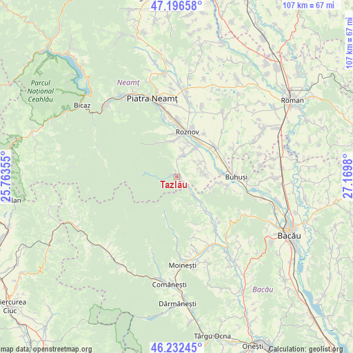
Tazlău GPS coordinates[2]
46° 43' 0.012" North, 26° 28' 0.012" East
| Map corner | latitude | longitude |
|---|---|---|
| Upper-left | 47.19658°, | 25.76355° |
| Center: | 46.71667°, | 26.46667° |
| Lower-right: | 46.23245°, | 27.1698° |
| Map W x H: | 107.2×107.2 km | = 66.6×66.6mi |
| max Lat: | 48.23793° ⇑28% North |
| Tazlău: | 46.71667° |
| min Lat: | ⇓72% South 43.65638° |
| min Long | Tazlău | max Long |
| 20.31667° | 26.46667° | 29.65403° |
| W 71.9%⇐ | ⇒28.1% E |
Elevation
Elevation of Tazlău is 440 m = 1444 ft, and this is 185.1 m = 607 ft above average elevation for this country.
| Max E: |
1278 m = 4193 ft | 15.5% |
| Tazlău | 440 m 1444 ft | |
| Avg. | 254.9 m = 836 ft | |
Min E: |
-2 m = -7 ft | 84.5% |
See also: Romania elevation on elevation.city.
Geographical zone
Tazlău is located in North temperate zone (between Tropic of Cancer and the Arctic Circle). Distance of this North polar circle is 2206.8 km =1371.2 mi to North.| Distance of | km | miles | from Tazlău |
|---|---|---|---|
| North Pole | 4812.7 | 2990.5 | to North |
| Arctic Circle | 2206.8 | 1371.2 | to North |
| Tropic Cancer | 2588.5 | 1608.4 | to South |
| Equator | 5194.4 | 3227.6 | to South |


Nearby cities:
15 places around Tazlău: (largest is in red/bold)
• Balcani
11.2 km =7 mi,  145°
145°
• Bețești
9.4 km =5.8 mi,  72°
72°
• Bolătău
10.5 km =6.5 mi,  208°
208°
• Borleşti
5.7 km =3.5 mi,  12°
12°
• Bărcăneşti
8.9 km =5.5 mi,  90°
90°
• Cândeşti
8.9 km =5.5 mi, 90°
• Frumoasa
8.3 km =5.2 mi,  136°
136°
• Luminiș
10.8 km =6.7 mi,  354°
354°
• Mastacăn
8.2 km =5.1 mi, 10°
• Poloboc
8 km =5 mi,  52°
52°
• Rediu
8.5 km =5.3 mi,  59°
59°
• Ruseni
10.6 km =6.6 mi,  31°
31°
• Schitu Frumoasa
9.2 km =5.7 mi,  169°
169°
• Socea
7.9 km =4.9 mi, 71°
• Vădurele
8.1 km =5 mi,  79°
79°
Sources, notices
• [Note1] Compared only with cities in Romania existing in our database
• [Src1] Map data: © OpenStreetMap contributors (CC-BY-SA)
• [Src2] Other city data from geonames.org with taken over terms of usage.
• [Src3] Geographical zone / Annual Mean Temperature by Robert A. Rohde @ Wikipedia
