Şuţeşti geodata
Şuţeşti (Brăila) is a seat of a second-order administrative division; located in Romania in Europe/Bucharest (GMT+3) time zone. With population of 4,740 people, there are 863 cities with bigger population in this country. Compared to other cities in Romania, 61.3% of cities are located further ↑North; 89.9% of cities are located further ←West and 95% of cities have higher elevation than Şuţeşti. Note1


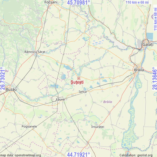
Şuţeşti GPS coordinates[2]
45° 13' 0.012" North, 27° 25' 59.988" East
| Map corner | latitude | longitude |
|---|---|---|
| Upper-left | 45.70981°, | 26.73021° |
| Center: | 45.21667°, | 27.43333° |
| Lower-right: | 44.71921°, | 28.13646° |
| Map W x H: | 110.1×110.1 km | = 68.4×68.4mi |
| max Lat: | 48.23793° ⇑61.3% North |
| Şuţeşti: | 45.21667° |
| min Lat: | ⇓38.7% South 43.65638° |
| min Long | Şuţeşti | max Long |
| 20.31667° | 27.43333° | 29.65403° |
| W 89.9%⇐ | ⇒10.1% E |
Elevation
Elevation of Şuţeşti is 35 m = 115 ft, and this is 219.9 m = 721 ft below average elevation for this country.
| Max E: |
1278 m = 4193 ft | 95% |
| Avg. | 254.9 m = 836 ft | |
| Şuţeşti | 35 m = 115 ft | |
Min E: |
-2 m = -7 ft | 5% |
See also: Romania elevation on elevation.city.
Geographical zone
Şuţeşti is located in North temperate zone (between Tropic of Cancer and the Arctic Circle). Distance of this North polar circle is 2373.6 km =1474.9 mi to North.| Distance of | km | miles | from Şuţeşti |
|---|---|---|---|
| North Pole | 4979.4 | 3094.1 | to North |
| Arctic Circle | 2373.6 | 1474.9 | to North |
| Tropic Cancer | 2421.7 | 1504.8 | to South |
| Equator | 5027.6 | 3124 | to South |


Nearby cities:
15 places around Şuţeşti: (largest is in red/bold)
• Amara
11.6 km =7.2 mi,  287°
287°
• Băile
9.9 km =6.2 mi,  325°
325°
• Dedulești
8.5 km =5.3 mi,  204°
204°
• Filipești
13.3 km =8.3 mi,  210°
210°
• Grădiştea
6.8 km =4.2 mi,  324°
324°
• Ianca
9.4 km =5.8 mi,  171°
171°
• Ibrianu
5.3 km =3.3 mi,  310°
310°
• Mircea Vodă
11.8 km =7.3 mi, 199°
• Movila Miresii
13.1 km =8.1 mi,  90°
90°
• Oprișenești
12.6 km =7.8 mi,  134°
134°
• Perișoru
12.6 km =7.8 mi,  156°
156°
• Plopu
9.9 km =6.2 mi,  140°
140°
• Racoviţa
9.4 km =5.8 mi,  8°
8°
• Râmnicelu
10.8 km =6.7 mi,  46°
46°
• Vişani
13.9 km =8.6 mi,  237°
237°
Sources, notices
• [Note1] Compared only with cities in Romania existing in our database
• [Src1] Map data: © OpenStreetMap contributors (CC-BY-SA)
• [Src2] Other city data from geonames.org with taken over terms of usage.
• [Src3] Geographical zone / Annual Mean Temperature by Robert A. Rohde @ Wikipedia
