Stăvaru geodata
Stăvaru (Olt) is a populated place; located in Romania in Europe/Bucharest (GMT+3) time zone. With population of 1,026 people, there are 4201 cities with bigger population in this country. Compared to other cities in Romania, 98.9% of cities are located further ↑North; 64.8% of cities are located further →East and 79.9% of cities have higher elevation than Stăvaru. Note1


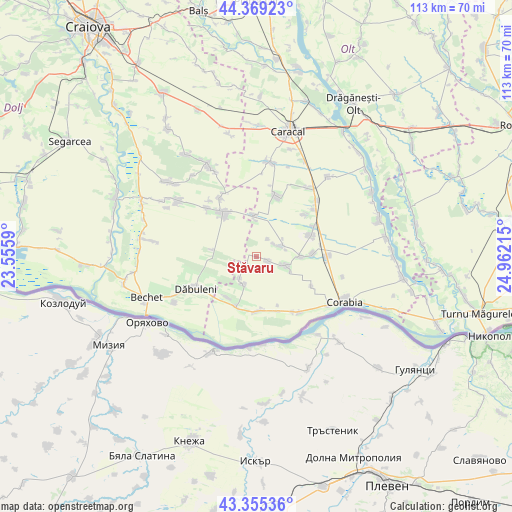
Stăvaru GPS coordinates[2]
43° 51' 52.02" North, 24° 15' 32.472" East
| Map corner | latitude | longitude |
|---|---|---|
| Upper-left | 44.36923°, | 23.5559° |
| Center: | 43.86445°, | 24.25902° |
| Lower-right: | 43.35536°, | 24.96215° |
| Map W x H: | 112.7×112.7 km | = 70×70mi |
| max Lat: | 48.23793° ⇑98.9% North |
| Stăvaru: | 43.86445° |
| min Lat: | ⇓1.1% South 43.65638° |
| min Long | Stăvaru | max Long |
| 20.31667° | 24.25902° | 29.65403° |
| W 35.2%⇐ | ⇒64.8% E |
Elevation
Elevation of Stăvaru is 95 m = 312 ft, and this is 159.9 m = 525 ft below average elevation for this country.
| Max E: |
1278 m = 4193 ft | 79.9% |
| Avg. | 254.9 m = 836 ft | |
| Stăvaru | 95 m = 312 ft | |
Min E: |
-2 m = -7 ft | 20.1% |
See also: Romania elevation on elevation.city.
Geographical zone
Stăvaru is located in North temperate zone (between Tropic of Cancer and the Arctic Circle). Distance of this Northern Tropic circle is 2271.4 km =1411.4 mi to South.| Distance of | km | miles | from Stăvaru |
|---|---|---|---|
| North Pole | 5129.8 | 3187.5 | to North |
| Arctic Circle | 2523.9 | 1568.3 | to North |
| Tropic Cancer | 2271.4 | 1411.4 | to South |
| Equator | 4877.3 | 3030.6 | to South |


Nearby cities:
15 places around Stăvaru: (largest is in red/bold)
• Amărăştii de Jos
12.1 km =7.5 mi,  322°
322°
• Bucinişu
9.5 km =5.9 mi,  355°
355°
• Bucinișu Mic
8 km =5 mi, 359°
• Câmpu Părului
4.8 km =3 mi,  33°
33°
• Grojdibodu
12.7 km =7.9 mi,  177°
177°
• Hotaru
12.3 km =7.6 mi, 182°
• Ianca
10.9 km =6.8 mi,  213°
213°
• Obârşia
6.3 km =3.9 mi,  70°
70°
• Ocolna
10.1 km =6.3 mi,  279°
279°
• Potelu
11.8 km =7.3 mi,  201°
201°
• Prapor
11.2 km =7 mi, 322°
• Urzica
2.6 km =1.6 mi,  109°
109°
• Vădastra
8.6 km =5.3 mi,  88°
88°
• Vădăstriţa
6.2 km =3.9 mi, 105°
• Ştefan cel Mare
6.7 km =4.2 mi, 207°
Sources, notices
• [Note1] Compared only with cities in Romania existing in our database
• [Src1] Map data: © OpenStreetMap contributors (CC-BY-SA)
• [Src2] Other city data from geonames.org with taken over terms of usage.
• [Src3] Geographical zone / Annual Mean Temperature by Robert A. Rohde @ Wikipedia
