Sânbotin geodata
Sânbotin (Vâlcea) is a populated place; located in Romania in Europe/Bucharest (GMT+3) time zone. With population of 834 people, there are 4907 cities with bigger population in this country. Compared to other cities in Romania, 62.5% of cities are located further ↑North; 62.1% of cities are located further →East and 61.3% of cities have lower elevation than Sânbotin. Note1


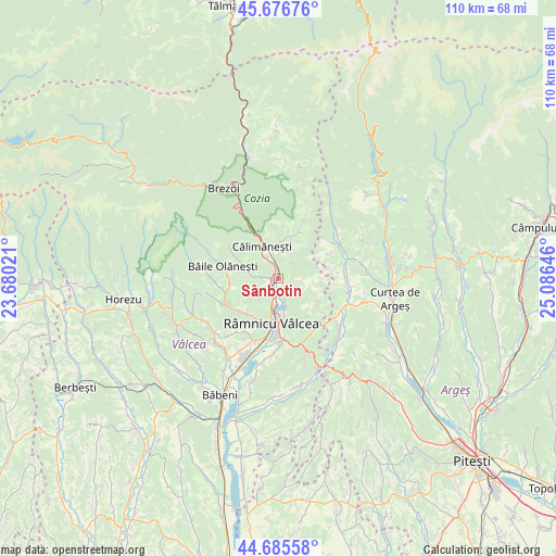
Sânbotin GPS coordinates[2]
45° 10' 59.988" North, 24° 22' 59.988" East
| Map corner | latitude | longitude |
|---|---|---|
| Upper-left | 45.67676°, | 23.68021° |
| Center: | 45.18333°, | 24.38333° |
| Lower-right: | 44.68558°, | 25.08646° |
| Map W x H: | 110.2×110.2 km | = 68.5×68.5mi |
| max Lat: | 48.23793° ⇑62.5% North |
| Sânbotin: | 45.18333° |
| min Lat: | ⇓37.5% South 43.65638° |
| min Long | Sânbotin | max Long |
| 20.31667° | 24.38333° | 29.65403° |
| W 37.9%⇐ | ⇒62.1% E |
Elevation
Elevation of Sânbotin is 271 m = 889 ft, and this is 16.1 m = 53 ft above average elevation for this country.
| Max E: |
1278 m = 4193 ft | 38.7% |
| Sânbotin | 271 m 889 ft | |
| Avg. | 254.9 m = 836 ft | |
Min E: |
-2 m = -7 ft | 61.3% |
See also: Romania elevation on elevation.city.
Geographical zone
Sânbotin is located in North temperate zone (between Tropic of Cancer and the Arctic Circle). Distance of this North polar circle is 2377.3 km =1477.2 mi to North.| Distance of | km | miles | from Sânbotin |
|---|---|---|---|
| North Pole | 4983.1 | 3096.4 | to North |
| Arctic Circle | 2377.3 | 1477.2 | to North |
| Tropic Cancer | 2418 | 1502.5 | to South |
| Equator | 5023.9 | 3121.7 | to South |


Nearby cities:
15 places around Sânbotin: (largest is in red/bold)
• Berislăveşti
7.9 km =4.9 mi,  19°
19°
• Bogdănești
3.3 km =2.1 mi,  255°
255°
• Bujoreni
6.1 km =3.8 mi,  205°
205°
• Călimăneşti
6.8 km =4.2 mi,  324°
324°
• Dăești
2 km =1.2 mi,  7°
7°
• Goranu
8.7 km =5.4 mi,  179°
179°
• Gura Văii
1.4 km =0.9 mi, 256°
• Jiblea Nouă
4.9 km =3 mi,  335°
335°
• Jiblea Veche
7.1 km =4.4 mi, 339°
• Muereasca
3.9 km =2.4 mi,  270°
270°
• Muereasca de Sus
7.3 km =4.5 mi,  287°
287°
• Olteni
4.2 km =2.6 mi, 178°
• Runcu
5.5 km =3.4 mi,  109°
109°
• Râmnicu Vâlcea
9.4 km =5.8 mi,  188°
188°
• Sălătrucel
7.4 km =4.6 mi,  0°
0°
Sources, notices
• [Note1] Compared only with cities in Romania existing in our database
• [Src1] Map data: © OpenStreetMap contributors (CC-BY-SA)
• [Src2] Other city data from geonames.org with taken over terms of usage.
• [Src3] Geographical zone / Annual Mean Temperature by Robert A. Rohde @ Wikipedia
