Şeitin geodata
Şeitin (Arad) is a seat of a second-order administrative division; located in Romania in Europe/Bucharest (GMT+2) time zone. With population of 2,943 people, there are 1821 cities with bigger population in this country. Compared to other cities in Romania, 57.2% of cities are located further ↓South; 99.6% of cities are located further →East and 81.4% of cities have higher elevation than Şeitin. Note1


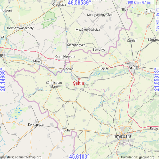
Şeitin GPS coordinates[2]
46° 6' 0" North, 20° 51' 0" East
| Map corner | latitude | longitude |
|---|---|---|
| Upper-left | 46.58539°, | 20.14688° |
| Center: | 46.1°, | 20.85° |
| Lower-right: | 45.6103°, | 21.55313° |
| Map W x H: | 108.4×108.4 km | = 67.4×67.4mi |
| max Lat: | 48.23793° ⇑42.8% North |
| Şeitin: | 46.1° |
| min Lat: | ⇓57.2% South 43.65638° |
| min Long | Şeitin | max Long |
| 20.31667° | 20.85° | 29.65403° |
| W 0.4%⇐ | ⇒99.6% E |
Elevation
Elevation of Şeitin is 90 m = 295 ft, and this is 164.9 m = 541 ft below average elevation for this country.
| Max E: |
1278 m = 4193 ft | 81.4% |
| Avg. | 254.9 m = 836 ft | |
| Şeitin | 90 m = 295 ft | |
Min E: |
-2 m = -7 ft | 18.6% |
See also: Romania elevation on elevation.city.
Geographical zone
Şeitin is located in North temperate zone (between Tropic of Cancer and the Arctic Circle). Distance of this North polar circle is 2275.3 km =1413.8 mi to North.| Distance of | km | miles | from Şeitin |
|---|---|---|---|
| North Pole | 4881.2 | 3033 | to North |
| Arctic Circle | 2275.3 | 1413.8 | to North |
| Tropic Cancer | 2519.9 | 1565.8 | to South |
| Equator | 5125.8 | 3185 | to South |


Nearby cities:
15 places around Şeitin: (largest is in red/bold)
• Igriș
5.2 km =3.2 mi,  286°
286°
• Lovrin
15.9 km =9.9 mi,  202°
202°
• Munar
13.1 km =8.1 mi,  88°
88°
• Nădlac
10.7 km =6.6 mi,  313°
313°
• Peregu Mare
15.3 km =9.5 mi,  14°
14°
• Periam
5.7 km =3.5 mi,  166°
166°
• Pesac
11.6 km =7.2 mi,  185°
185°
• Saravale
9.1 km =5.7 mi,  247°
247°
• Satu Mare
9.2 km =5.7 mi,  114°
114°
• Secusigiu
10.4 km =6.5 mi,  100°
100°
• Semlac
6.7 km =4.2 mi,  73°
73°
• Sânpetru German
15.4 km =9.6 mi,  84°
84°
• Sânpetru Mare
6.6 km =4.1 mi, 201°
• Sânpetru Mic
16.4 km =10.2 mi,  118°
118°
• Variaş
12.1 km =7.5 mi,  140°
140°
Sources, notices
• [Note1] Compared only with cities in Romania existing in our database
• [Src1] Map data: © OpenStreetMap contributors (CC-BY-SA)
• [Src2] Other city data from geonames.org with taken over terms of usage.
• [Src3] Geographical zone / Annual Mean Temperature by Robert A. Rohde @ Wikipedia
