Râfov geodata
Râfov (Prahova) is a seat of a second-order administrative division; located in Romania in Europe/Bucharest (GMT+3) time zone. With population of 5,472 people, there are 642 cities with bigger population in this country. Compared to other cities in Romania, 74.4% of cities are located further ↑North; 65.6% of cities are located further ←West and 77.7% of cities have higher elevation than Râfov. Note1


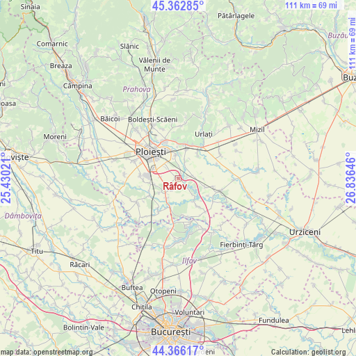
Râfov GPS coordinates[2]
44° 52' 0.012" North, 26° 7' 59.988" East
| Map corner | latitude | longitude |
|---|---|---|
| Upper-left | 45.36285°, | 25.43021° |
| Center: | 44.86667°, | 26.13333° |
| Lower-right: | 44.36617°, | 26.83646° |
| Map W x H: | 110.8×110.8 km | = 68.8×68.8mi |
| max Lat: | 48.23793° ⇑74.4% North |
| Râfov: | 44.86667° |
| min Lat: | ⇓25.6% South 43.65638° |
| min Long | Râfov | max Long |
| 20.31667° | 26.13333° | 29.65403° |
| W 65.6%⇐ | ⇒34.4% E |
Elevation
Elevation of Râfov is 102 m = 335 ft, and this is 152.9 m = 502 ft below average elevation for this country.
| Max E: |
1278 m = 4193 ft | 77.7% |
| Avg. | 254.9 m = 836 ft | |
| Râfov | 102 m = 335 ft | |
Min E: |
-2 m = -7 ft | 22.3% |
See also: Romania elevation on elevation.city.
Geographical zone
Râfov is located in North temperate zone (between Tropic of Cancer and the Arctic Circle). Distance of this Northern Tropic circle is 2382.8 km =1480.6 mi to South.| Distance of | km | miles | from Râfov |
|---|---|---|---|
| North Pole | 5018.4 | 3118.3 | to North |
| Arctic Circle | 2412.5 | 1499.1 | to North |
| Tropic Cancer | 2382.8 | 1480.6 | to South |
| Equator | 4988.7 | 3099.8 | to South |


Nearby cities:
15 places around Râfov: (largest is in red/bold)
• Buda
6.2 km =3.9 mi,  138°
138°
• Corlătești
6.3 km =3.9 mi,  325°
325°
• Coslegi
4.6 km =2.9 mi,  26°
26°
• Cătunu
3.8 km =2.4 mi,  2°
2°
• Dumbrava
4.4 km =2.7 mi,  64°
64°
• Dârvari
5.9 km =3.7 mi,  19°
19°
• Ghighiu
5.3 km =3.3 mi,  310°
310°
• Goga
2.3 km =1.4 mi, 16°
• Moara
6.3 km =3.9 mi,  234°
234°
• Moara Domnească
1.7 km =1.1 mi,  127°
127°
• Mălăiești
1.2 km =0.7 mi,  282°
282°
• Pietroșani
3.8 km =2.4 mi,  217°
217°
• Puchenii Mari
6.8 km =4.2 mi, 215°
• Românești
5.3 km =3.3 mi,  270°
270°
• Zănoaga
2.4 km =1.5 mi,  89°
89°
Sources, notices
• [Note1] Compared only with cities in Romania existing in our database
• [Src1] Map data: © OpenStreetMap contributors (CC-BY-SA)
• [Src2] Other city data from geonames.org with taken over terms of usage.
• [Src3] Geographical zone / Annual Mean Temperature by Robert A. Rohde @ Wikipedia
