Războieni-Cetate geodata
Războieni-Cetate (Alba) is a populated place; located in Romania in Europe/Bucharest (GMT+3) time zone. With population of 1,508 people, there are 3160 cities with bigger population in this country. Compared to other cities in Romania, 64.9% of cities are located further ↓South; 71.5% of cities are located further →East and 58.9% of cities have lower elevation than Războieni-Cetate. Note1


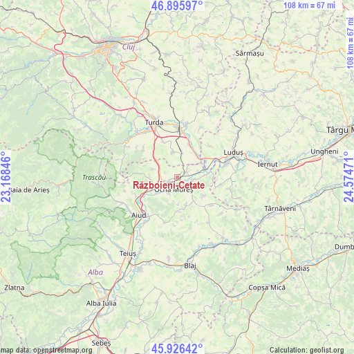
Războieni-Cetate GPS coordinates[2]
46° 24' 48.06" North, 23° 52' 17.688" East
| Map corner | latitude | longitude |
|---|---|---|
| Upper-left | 46.89597°, | 23.16846° |
| Center: | 46.41335°, | 23.87158° |
| Lower-right: | 45.92642°, | 24.57471° |
| Map W x H: | 107.8×107.8 km | = 67×67mi |
| max Lat: | 48.23793° ⇑35.1% North |
| Războieni-Cetate: | 46.41335° |
| min Lat: | ⇓64.9% South 43.65638° |
| min Long | Războieni-Ceta | max Long |
| 20.31667° | 23.87158° | 29.65403° |
| W 28.5%⇐ | ⇒71.5% E |
Elevation
Elevation of Războieni-Cetate is 257 m = 843 ft, and this is 2.1 m = 7 ft above average elevation for this country.
| Max E: |
1278 m = 4193 ft | 41.1% |
| Războieni-Cetate | 257 m 843 ft | |
| Avg. | 254.9 m = 836 ft | |
Min E: |
-2 m = -7 ft | 58.9% |
See also: Romania elevation on elevation.city.
Geographical zone
Războieni-Cetate is located in North temperate zone (between Tropic of Cancer and the Arctic Circle). Distance of this North polar circle is 2240.5 km =1392.2 mi to North.| Distance of | km | miles | from Războieni-Cetate |
|---|---|---|---|
| North Pole | 4846.4 | 3011.4 | to North |
| Arctic Circle | 2240.5 | 1392.2 | to North |
| Tropic Cancer | 2554.8 | 1587.5 | to South |
| Equator | 5160.7 | 3206.7 | to South |


Nearby cities:
15 places around Războieni-Cetate: (largest is in red/bold)
• Bogata
12.2 km =7.6 mi,  338°
338°
• Cisteiu de Mureș
6 km =3.7 mi,  228°
228°
• Călăraşi
7.8 km =4.8 mi,  357°
357°
• Decea
8.9 km =5.5 mi,  247°
247°
• Gligorești
8.9 km =5.5 mi,  64°
64°
• Gura Arieșului
6.8 km =4.2 mi,  74°
74°
• Hopârta
10.2 km =6.3 mi,  179°
179°
• Hădăreni
10.5 km =6.5 mi, 55°
• Luna
11 km =6.8 mi,  19°
19°
• Lunca Mureşului
3.1 km =1.9 mi,  44°
44°
• Luncani
9 km =5.6 mi, 42°
• Noşlac
5 km =3.1 mi,  107°
107°
• Ocna Mureş
3.7 km =2.3 mi,  206°
206°
• Uioara de Jos
5.4 km =3.4 mi, 208°
• Unirea
4.6 km =2.9 mi,  256°
256°
Sources, notices
• [Note1] Compared only with cities in Romania existing in our database
• [Src1] Map data: © OpenStreetMap contributors (CC-BY-SA)
• [Src2] Other city data from geonames.org with taken over terms of usage.
• [Src3] Geographical zone / Annual Mean Temperature by Robert A. Rohde @ Wikipedia
