Rașca geodata
Rașca (Suceava) is a populated place; located in Romania in Europe/Bucharest (GMT+3) time zone. With population of 782 people, there are 5137 cities with bigger population in this country. Compared to other cities in Romania, 95.6% of cities are located further ↓South; 54.7% of cities are located further ←West and 97.5% of cities have lower elevation than Rașca. Note1


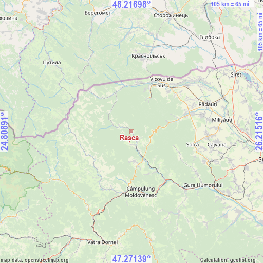
Rașca GPS coordinates[2]
47° 44' 46.788" North, 25° 30' 43.308" East
| Map corner | latitude | longitude |
|---|---|---|
| Upper-left | 48.21698°, | 24.80891° |
| Center: | 47.74633°, | 25.51203° |
| Lower-right: | 47.27139°, | 26.21516° |
| Map W x H: | 105.1×105.1 km | = 65.3×65.3mi |
| max Lat: | 48.23793° ⇑4.4% North |
| Rașca: | 47.74633° |
| min Lat: | ⇓95.6% South 43.65638° |
| min Long | Rașca | max Long |
| 20.31667° | 25.51203° | 29.65403° |
| W 54.7%⇐ | ⇒45.3% E |
Elevation
Elevation of Rașca is 743 m = 2438 ft, and this is 488.1 m = 1601 ft above average elevation for this country.
| Max E: |
1278 m = 4193 ft | 2.5% |
| Rașca | 743 m 2438 ft | |
| Avg. | 254.9 m = 836 ft | |
Min E: |
-2 m = -7 ft | 97.5% |
See also: Romania elevation on elevation.city.
Geographical zone
Rașca is located in North temperate zone (between Tropic of Cancer and the Arctic Circle). Distance of this North polar circle is 2092.3 km =1300.1 mi to North.| Distance of | km | miles | from Rașca |
|---|---|---|---|
| North Pole | 4698.2 | 2919.3 | to North |
| Arctic Circle | 2092.3 | 1300.1 | to North |
| Tropic Cancer | 2703 | 1679.6 | to South |
| Equator | 5308.9 | 3298.8 | to South |


Nearby cities:
15 places around Rașca: (largest is in red/bold)
• Argel
3.5 km =2.2 mi,  298°
298°
• Benia
20.5 km =12.7 mi,  243°
243°
• Brodina
16.8 km =10.4 mi,  334°
334°
• Brodina
18.3 km =11.4 mi,  282°
282°
• Deia
18.6 km =11.6 mi,  154°
154°
• Demacușa
5.5 km =3.4 mi,  185°
185°
• Falcău
18.6 km =11.6 mi,  350°
350°
• Frumosu
17.7 km =11 mi,  144°
144°
• Gura Putnei
18.1 km =11.2 mi,  20°
20°
• Moldoviţa
7.2 km =4.5 mi,  167°
167°
• Putna
15.5 km =9.6 mi,  30°
30°
• Straja
19.2 km =11.9 mi,  8°
8°
• Suceviţa
15.8 km =9.8 mi,  74°
74°
• Vatra Moldoviţei
11.5 km =7.1 mi,  159°
159°
• Voievodeasa
18.7 km =11.6 mi, 71°
Sources, notices
• [Note1] Compared only with cities in Romania existing in our database
• [Src1] Map data: © OpenStreetMap contributors (CC-BY-SA)
• [Src2] Other city data from geonames.org with taken over terms of usage.
• [Src3] Geographical zone / Annual Mean Temperature by Robert A. Rohde @ Wikipedia
