Rădăşeni geodata
Rădăşeni (Suceava) is a seat of a second-order administrative division; located in Romania in Europe/Bucharest (GMT+3) time zone. With population of 4,404 people, there are 990 cities with bigger population in this country. Compared to other cities in Romania, 90.2% of cities are located further ↓South; 67.8% of cities are located further ←West and 72.3% of cities have lower elevation than Rădăşeni. Note1


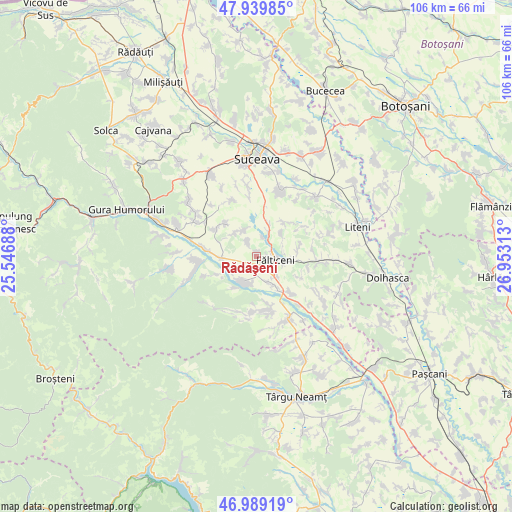
Rădăşeni GPS coordinates[2]
47° 28' 0.012" North, 26° 15' 0" East
| Map corner | latitude | longitude |
|---|---|---|
| Upper-left | 47.93985°, | 25.54688° |
| Center: | 47.46667°, | 26.25° |
| Lower-right: | 46.98919°, | 26.95313° |
| Map W x H: | 105.7×105.7 km | = 65.7×65.7mi |
| max Lat: | 48.23793° ⇑9.8% North |
| Rădăşeni: | 47.46667° |
| min Lat: | ⇓90.2% South 43.65638° |
| min Long | Rădăşeni | max Long |
| 20.31667° | 26.25° | 29.65403° |
| W 67.8%⇐ | ⇒32.2% E |
Elevation
Elevation of Rădăşeni is 336 m = 1102 ft, and this is 81.1 m = 266 ft above average elevation for this country.
| Max E: |
1278 m = 4193 ft | 27.7% |
| Rădăşeni | 336 m 1102 ft | |
| Avg. | 254.9 m = 836 ft | |
Min E: |
-2 m = -7 ft | 72.3% |
See also: Romania elevation on elevation.city.
Geographical zone
Rădăşeni is located in North temperate zone (between Tropic of Cancer and the Arctic Circle). Distance of this North polar circle is 2123.4 km =1319.4 mi to North.| Distance of | km | miles | from Rădăşeni |
|---|---|---|---|
| North Pole | 4729.3 | 2938.6 | to North |
| Arctic Circle | 2123.4 | 1319.4 | to North |
| Tropic Cancer | 2671.9 | 1660.2 | to South |
| Equator | 5277.8 | 3279.5 | to South |


Nearby cities:
15 places around Rădăşeni: (largest is in red/bold)
• Baia
6.1 km =3.8 mi,  204°
204°
• Bogata
8.1 km =5 mi,  216°
216°
• Brădățel
7.3 km =4.5 mi,  300°
300°
• Bunești
7.1 km =4.4 mi,  23°
23°
• Cornu Luncii
7.5 km =4.7 mi,  270°
270°
• Cotu Băii
5.8 km =3.6 mi,  155°
155°
• Fântâna Mare
6.9 km =4.3 mi,  147°
147°
• Fântânele
7.5 km =4.7 mi,  42°
42°
• Fălticeni
4.2 km =2.6 mi,  116°
116°
• Lămășeni
3.4 km =2.1 mi,  330°
330°
• Mihăiești
6 km =3.7 mi,  335°
335°
• Petia
7.1 km =4.4 mi,  47°
47°
• Sasca Mică
6.2 km =3.9 mi,  240°
240°
• Șoldănești
5.8 km =3.6 mi,  106°
106°
• Țarna Mare
5.9 km =3.7 mi,  83°
83°
Sources, notices
• [Note1] Compared only with cities in Romania existing in our database
• [Src1] Map data: © OpenStreetMap contributors (CC-BY-SA)
• [Src2] Other city data from geonames.org with taken over terms of usage.
• [Src3] Geographical zone / Annual Mean Temperature by Robert A. Rohde @ Wikipedia
