Prăjeni geodata
Prăjeni (Botoşani) is a seat of a second-order administrative division; located in Romania in Europe/Bucharest (GMT+3) time zone. With population of 3,265 people, there are 1578 cities with bigger population in this country. Compared to other cities in Romania, 91.2% of cities are located further ↓South; 83.1% of cities are located further ←West and 57.4% of cities have higher elevation than Prăjeni. Note1


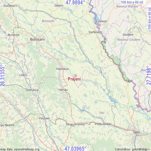
Prăjeni GPS coordinates[2]
47° 31' 0.012" North, 27° 1' 0.012" East
| Map corner | latitude | longitude |
|---|---|---|
| Upper-left | 47.9894°, | 26.31355° |
| Center: | 47.51667°, | 27.01667° |
| Lower-right: | 47.03965°, | 27.7198° |
| Map W x H: | 105.6×105.6 km | = 65.6×65.6mi |
| max Lat: | 48.23793° ⇑8.8% North |
| Prăjeni: | 47.51667° |
| min Lat: | ⇓91.2% South 43.65638° |
| min Long | Prăjeni | max Long |
| 20.31667° | 27.01667° | 29.65403° |
| W 83.1%⇐ | ⇒16.9% E |
Elevation
Elevation of Prăjeni is 176 m = 577 ft, and this is 78.9 m = 259 ft below average elevation for this country.
| Max E: |
1278 m = 4193 ft | 57.4% |
| Avg. | 254.9 m = 836 ft | |
| Prăjeni | 176 m = 577 ft | |
Min E: |
-2 m = -7 ft | 42.6% |
See also: Romania elevation on elevation.city.
Geographical zone
Prăjeni is located in North temperate zone (between Tropic of Cancer and the Arctic Circle). Distance of this North polar circle is 2117.8 km =1315.9 mi to North.| Distance of | km | miles | from Prăjeni |
|---|---|---|---|
| North Pole | 4723.7 | 2935.2 | to North |
| Arctic Circle | 2117.8 | 1315.9 | to North |
| Tropic Cancer | 2677.4 | 1663.7 | to South |
| Equator | 5283.4 | 3283 | to South |


Nearby cities:
15 places around Prăjeni: (largest is in red/bold)
• Borosoaia
8.6 km =5.3 mi,  134°
134°
• Boscoteni
11.1 km =6.9 mi,  264°
264°
• Chițoveni
8.5 km =5.3 mi,  311°
311°
• Câmpeni
2 km =1.2 mi,  234°
234°
• Feredeni
10.9 km =6.8 mi,  250°
250°
• Frumuşica
9 km =5.6 mi,  281°
281°
• Lupăria
2.9 km =1.8 mi,  169°
169°
• Miletin
5.2 km =3.2 mi,  138°
138°
• Nicolae Bălcescu
10.6 km =6.6 mi,  301°
301°
• Plugari
7.3 km =4.5 mi,  120°
120°
• Prisăcani
6.8 km =4.2 mi, 312°
• Rădeni
9.3 km =5.8 mi,  266°
266°
• Slobozia
10.5 km =6.5 mi, 245°
• Vlădeni-Deal
10.8 km =6.7 mi, 273°
• Șendreni
11 km =6.8 mi, 282°
Sources, notices
• [Note1] Compared only with cities in Romania existing in our database
• [Src1] Map data: © OpenStreetMap contributors (CC-BY-SA)
• [Src2] Other city data from geonames.org with taken over terms of usage.
• [Src3] Geographical zone / Annual Mean Temperature by Robert A. Rohde @ Wikipedia
