Plumbuita geodata
Plumbuita (Călăraşi) is a populated place; located in Romania in Europe/Bucharest (GMT+3) time zone. With population of 526 people, there are 6809 cities with bigger population in this country. Compared to other cities in Romania, 86.5% of cities are located further ↑North; 74.2% of cities are located further ←West and 90.4% of cities have higher elevation than Plumbuita. Note1


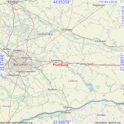
Plumbuita GPS coordinates[2]
44° 27' 13.86" North, 26° 34' 37.848" East
| Map corner | latitude | longitude |
|---|---|---|
| Upper-left | 44.95359°, | 25.87406° |
| Center: | 44.45385°, | 26.57718° |
| Lower-right: | 43.94979°, | 27.28031° |
| Map W x H: | 111.6×111.6 km | = 69.3×69.3mi |
| max Lat: | 48.23793° ⇑86.5% North |
| Plumbuita: | 44.45385° |
| min Lat: | ⇓13.5% South 43.65638° |
| min Long | Plumbuita | max Long |
| 20.31667° | 26.57718° | 29.65403° |
| W 74.2%⇐ | ⇒25.8% E |
Elevation
Elevation of Plumbuita is 56 m = 184 ft, and this is 198.9 m = 653 ft below average elevation for this country.
| Max E: |
1278 m = 4193 ft | 90.4% |
| Avg. | 254.9 m = 836 ft | |
| Plumbuita | 56 m = 184 ft | |
Min E: |
-2 m = -7 ft | 9.6% |
See also: Romania elevation on elevation.city.
Geographical zone
Plumbuita is located in North temperate zone (between Tropic of Cancer and the Arctic Circle). Distance of this Northern Tropic circle is 2336.9 km =1452.1 mi to South.| Distance of | km | miles | from Plumbuita |
|---|---|---|---|
| North Pole | 5064.3 | 3146.8 | to North |
| Arctic Circle | 2458.4 | 1527.6 | to North |
| Tropic Cancer | 2336.9 | 1452.1 | to South |
| Equator | 4942.8 | 3071.3 | to South |


Nearby cities:
15 places around Plumbuita: (largest is in red/bold)
• Belciugatele
11.9 km =7.4 mi,  286°
286°
• Coțofanca
12.8 km =8 mi,  129°
129°
• Drăgoeşti-Snagov
13 km =8.1 mi,  344°
344°
• Drăgoești
13 km =8.1 mi,  346°
346°
• Florica
6.5 km =4 mi,  47°
47°
• Fundulea
5 km =3.1 mi, 286°
• Gostilele
8.4 km =5.2 mi,  310°
310°
• Gurbăneşti
12.5 km =7.8 mi, 128°
• Ileana
10 km =6.2 mi, 45°
• Măriuța
11.6 km =7.2 mi,  320°
320°
• Progresu
14 km =8.7 mi,  221°
221°
• Săndulița
6 km =3.7 mi, 131°
• Săruleşti
7.1 km =4.4 mi, 125°
• Sărulești-Gară
6.5 km =4 mi,  99°
99°
• Tămădău Mare
2.6 km =1.6 mi,  303°
303°
Sources, notices
• [Note1] Compared only with cities in Romania existing in our database
• [Src1] Map data: © OpenStreetMap contributors (CC-BY-SA)
• [Src2] Other city data from geonames.org with taken over terms of usage.
• [Src3] Geographical zone / Annual Mean Temperature by Robert A. Rohde @ Wikipedia
