Păulești geodata
Păulești (Vrancea) is a seat of a second-order administrative division; located in Romania in Europe/Bucharest (GMT+3) time zone. With population of 1,344 people, there are 3438 cities with bigger population in this country. Compared to other cities in Romania, 52.5% of cities are located further ↓South; 76.5% of cities are located further ←West and 86.5% of cities have lower elevation than Păulești. Note1


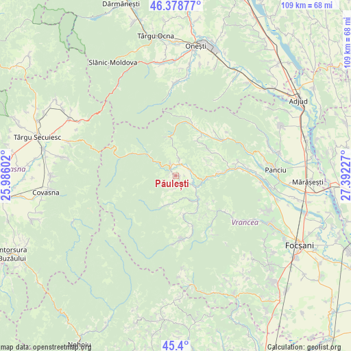
Păulești GPS coordinates[2]
45° 53' 29.544" North, 26° 41' 20.904" East
| Map corner | latitude | longitude |
|---|---|---|
| Upper-left | 46.37877°, | 25.98602° |
| Center: | 45.89154°, | 26.68914° |
| Lower-right: | 45.4°, | 27.39227° |
| Map W x H: | 108.8×108.8 km | = 67.6×67.6mi |
| max Lat: | 48.23793° ⇑47.5% North |
| Păulești: | 45.89154° |
| min Lat: | ⇓52.5% South 43.65638° |
| min Long | Păulești | max Long |
| 20.31667° | 26.68914° | 29.65403° |
| W 76.5%⇐ | ⇒23.5% E |
Elevation
Elevation of Păulești is 463 m = 1519 ft, and this is 208.1 m = 683 ft above average elevation for this country.
| Max E: |
1278 m = 4193 ft | 13.5% |
| Păulești | 463 m 1519 ft | |
| Avg. | 254.9 m = 836 ft | |
Min E: |
-2 m = -7 ft | 86.5% |
See also: Romania elevation on elevation.city.
Geographical zone
Păulești is located in North temperate zone (between Tropic of Cancer and the Arctic Circle). Distance of this North polar circle is 2298.5 km =1428.2 mi to North.| Distance of | km | miles | from Păulești |
|---|---|---|---|
| North Pole | 4904.4 | 3047.5 | to North |
| Arctic Circle | 2298.5 | 1428.2 | to North |
| Tropic Cancer | 2496.7 | 1551.4 | to South |
| Equator | 5102.7 | 3170.7 | to South |


Nearby cities:
15 places around Păulești: (largest is in red/bold)
• Bârseşti
4.4 km =2.7 mi,  50°
50°
• Colacu
10.8 km =6.7 mi,  91°
91°
• Coza
2.4 km =1.5 mi,  319°
319°
• Hăulișca
1 km =0.6 mi,  198°
198°
• Mătăcina
8.6 km =5.3 mi,  96°
96°
• Negrilești
5.2 km =3.2 mi,  14°
14°
• Nistoreşti
7.3 km =4.5 mi,  152°
152°
• Năruja
9.8 km =6.1 mi,  131°
131°
• Poiana
5.7 km =3.5 mi,  108°
108°
• Spinești
1.3 km =0.8 mi, 86°
• Topești
5.2 km =3.2 mi,  72°
72°
• Tulnici
3.3 km =2.1 mi,  328°
328°
• Valea Sării
8.6 km =5.3 mi, 100°
• Viișoara
10.9 km =6.8 mi, 72°
• Vrâncioaia
5.7 km =3.5 mi,  143°
143°
Sources, notices
• [Note1] Compared only with cities in Romania existing in our database
• [Src1] Map data: © OpenStreetMap contributors (CC-BY-SA)
• [Src2] Other city data from geonames.org with taken over terms of usage.
• [Src3] Geographical zone / Annual Mean Temperature by Robert A. Rohde @ Wikipedia
