Păltiniș-Ciuc geodata
Păltiniș-Ciuc (Harghita) is a populated place; located in Romania in Europe/Bucharest (GMT+3) time zone. With population of 638 people, there are 5954 cities with bigger population in this country. Compared to other cities in Romania, 68.1% of cities are located further ↓South; 62.3% of cities are located further ←West and 99.2% of cities have lower elevation than Păltiniș-Ciuc. Note1


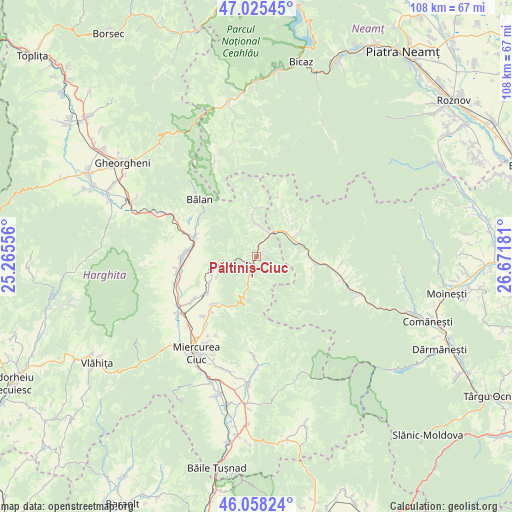
Păltiniș-Ciuc GPS coordinates[2]
46° 32' 38.4" North, 25° 58' 7.248" East
| Map corner | latitude | longitude |
|---|---|---|
| Upper-left | 47.02545°, | 25.26556° |
| Center: | 46.544°, | 25.96868° |
| Lower-right: | 46.05824°, | 26.67181° |
| Map W x H: | 107.5×107.5 km | = 66.8×66.8mi |
| max Lat: | 48.23793° ⇑31.9% North |
| Păltiniș-Ciuc: | 46.544° |
| min Lat: | ⇓68.1% South 43.65638° |
| min Long | Păltiniș-Ciuc | max Long |
| 20.31667° | 25.96868° | 29.65403° |
| W 62.3%⇐ | ⇒37.7% E |
Elevation
Elevation of Păltiniș-Ciuc is 873 m = 2864 ft, and this is 618.1 m = 2028 ft above average elevation for this country.
| Max E: |
1278 m = 4193 ft | 0.8% |
| Păltiniș-Ciuc | 873 m 2864 ft | |
| Avg. | 254.9 m = 836 ft | |
Min E: |
-2 m = -7 ft | 99.2% |
See also: Romania elevation on elevation.city.
Geographical zone
Păltiniș-Ciuc is located in North temperate zone (between Tropic of Cancer and the Arctic Circle). Distance of this North polar circle is 2226 km =1383.2 mi to North.| Distance of | km | miles | from Păltiniș-Ciuc |
|---|---|---|---|
| North Pole | 4831.9 | 3002.4 | to North |
| Arctic Circle | 2226 | 1383.2 | to North |
| Tropic Cancer | 2569.3 | 1596.5 | to South |
| Equator | 5175.2 | 3215.7 | to South |


Nearby cities:
15 places around Păltiniș-Ciuc: (largest is in red/bold)
• Bolovăniș
10.3 km =6.4 mi,  38°
38°
• Ciugheș
11.8 km =7.3 mi,  101°
101°
• Făget
8.2 km =5.1 mi,  52°
52°
• Ghimeş-Făget
8.7 km =5.4 mi,  59°
59°
• Ghimeș
9.6 km =6 mi,  73°
73°
• Izvorul Trotușului
7 km =4.3 mi,  196°
196°
• Livezi
9.5 km =5.9 mi,  252°
252°
• Lunca de Jos
2.8 km =1.7 mi,  23°
23°
• Lunca de Sus
1.2 km =0.7 mi,  187°
187°
• Nădejdea
11.2 km =7 mi,  241°
241°
• Palanca
11.4 km =7.1 mi, 95°
• Popoiu
11.4 km =7.1 mi,  91°
91°
• Tărhăuși
10.5 km =6.5 mi, 60°
• Valea Rece
8.6 km =5.3 mi,  354°
354°
• Valea Ugra
2.2 km =1.4 mi,  163°
163°
Sources, notices
• [Note1] Compared only with cities in Romania existing in our database
• [Src1] Map data: © OpenStreetMap contributors (CC-BY-SA)
• [Src2] Other city data from geonames.org with taken over terms of usage.
• [Src3] Geographical zone / Annual Mean Temperature by Robert A. Rohde @ Wikipedia
