Ochiuri geodata
Ochiuri (Dâmboviţa) is a populated place; located in Romania in Europe/Bucharest (GMT+3) time zone. With population of 541 people, there are 6671 cities with bigger population in this country. Compared to other cities in Romania, 71% of cities are located further ↑North; 55.2% of cities are located further ←West and 59.4% of cities have lower elevation than Ochiuri. Note1


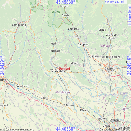
Ochiuri GPS coordinates[2]
44° 57' 46.944" North, 25° 32' 45.708" East
| Map corner | latitude | longitude |
|---|---|---|
| Upper-left | 45.45839°, | 24.84291° |
| Center: | 44.96304°, | 25.54603° |
| Lower-right: | 44.46338°, | 26.24916° |
| Map W x H: | 110.6×110.6 km | = 68.7×68.7mi |
| max Lat: | 48.23793° ⇑71% North |
| Ochiuri: | 44.96304° |
| min Lat: | ⇓29% South 43.65638° |
| min Long | Ochiuri | max Long |
| 20.31667° | 25.54603° | 29.65403° |
| W 55.2%⇐ | ⇒44.8% E |
Elevation
Elevation of Ochiuri is 260 m = 853 ft, and this is 5.1 m = 17 ft above average elevation for this country.
| Max E: |
1278 m = 4193 ft | 40.6% |
| Ochiuri | 260 m 853 ft | |
| Avg. | 254.9 m = 836 ft | |
Min E: |
-2 m = -7 ft | 59.4% |
See also: Romania elevation on elevation.city.
Geographical zone
Ochiuri is located in North temperate zone (between Tropic of Cancer and the Arctic Circle). Distance of this Northern Tropic circle is 2393.5 km =1487.3 mi to South.| Distance of | km | miles | from Ochiuri |
|---|---|---|---|
| North Pole | 5007.6 | 3111.6 | to North |
| Arctic Circle | 2401.8 | 1492.4 | to North |
| Tropic Cancer | 2393.5 | 1487.3 | to South |
| Equator | 4999.4 | 3106.5 | to South |


Nearby cities:
15 places around Ochiuri: (largest is in red/bold)
• Adânca
6.8 km =4.2 mi,  131°
131°
• Aninoasa
8.9 km =5.5 mi,  272°
272°
• Comişani
9.3 km =5.8 mi,  161°
161°
• Glodeni
8.6 km =5.3 mi,  313°
313°
• Gorgota
3.3 km =2.1 mi,  296°
296°
• Gura Ocniței
3 km =1.9 mi,  143°
143°
• Moreni
8 km =5 mi,  73°
73°
• Ocniţa
2.3 km =1.4 mi,  7°
7°
• Răzvad
3.5 km =2.2 mi,  196°
196°
• Schela
9.3 km =5.8 mi,  323°
323°
• Săcueni
6.2 km =3.9 mi, 160°
• Târgovişte
8.2 km =5.1 mi,  239°
239°
• Ulmi
7.9 km =4.9 mi,  207°
207°
• Valea Voievozilor
5.5 km =3.4 mi, 239°
• Viforâta
6.9 km =4.3 mi, 267°
Sources, notices
• [Note1] Compared only with cities in Romania existing in our database
• [Src1] Map data: © OpenStreetMap contributors (CC-BY-SA)
• [Src2] Other city data from geonames.org with taken over terms of usage.
• [Src3] Geographical zone / Annual Mean Temperature by Robert A. Rohde @ Wikipedia
