Negoiești geodata
Negoiești (Bacău) is a populated place; located in Romania in Europe/Bucharest (GMT+3) time zone. With population of 878 people, there are 4714 cities with bigger population in this country. Compared to other cities in Romania, 59.7% of cities are located further ↓South; 80.8% of cities are located further ←West and 58.1% of cities have higher elevation than Negoiești. Note1


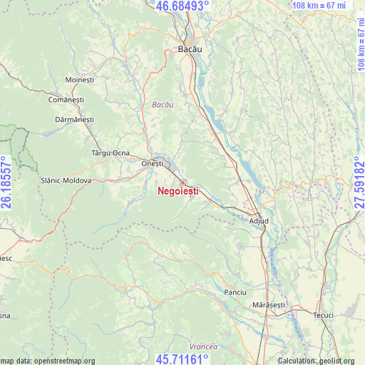
Negoiești GPS coordinates[2]
46° 12' 1.548" North, 26° 53' 19.284" East
| Map corner | latitude | longitude |
|---|---|---|
| Upper-left | 46.68493°, | 26.18557° |
| Center: | 46.20043°, | 26.88869° |
| Lower-right: | 45.71161°, | 27.59182° |
| Map W x H: | 108.2×108.2 km | = 67.2×67.2mi |
| max Lat: | 48.23793° ⇑40.3% North |
| Negoiești: | 46.20043° |
| min Lat: | ⇓59.7% South 43.65638° |
| min Long | Negoiești | max Long |
| 20.31667° | 26.88869° | 29.65403° |
| W 80.8%⇐ | ⇒19.2% E |
Elevation
Elevation of Negoiești is 173 m = 568 ft, and this is 81.9 m = 269 ft below average elevation for this country.
| Max E: |
1278 m = 4193 ft | 58.1% |
| Avg. | 254.9 m = 836 ft | |
| Negoiești | 173 m = 568 ft | |
Min E: |
-2 m = -7 ft | 41.9% |
See also: Romania elevation on elevation.city.
Geographical zone
Negoiești is located in North temperate zone (between Tropic of Cancer and the Arctic Circle). Distance of this North polar circle is 2264.2 km =1406.9 mi to North.| Distance of | km | miles | from Negoiești |
|---|---|---|---|
| North Pole | 4870.1 | 3026.1 | to North |
| Arctic Circle | 2264.2 | 1406.9 | to North |
| Tropic Cancer | 2531.1 | 1572.8 | to South |
| Equator | 5137 | 3192 | to South |


Nearby cities:
15 places around Negoiești: (largest is in red/bold)
• Blidari
5 km =3.1 mi,  150°
150°
• Bogdana
3.7 km =2.3 mi,  247°
247°
• Borzești
7 km =4.3 mi,  311°
311°
• Borșani
8.9 km =5.5 mi,  128°
128°
• Buciumi
8 km =5 mi,  271°
271°
• Coţofăneşti
9.2 km =5.7 mi, 127°
• Căiuţi-Sat
3.9 km =2.4 mi,  118°
118°
• Căiuți
3.6 km =2.2 mi, 127°
• Gura Văii
9.3 km =5.8 mi,  328°
328°
• Gutinaș
5.2 km =3.2 mi,  275°
275°
• Popeni
4.8 km =3 mi, 132°
• Răcăuți
8.3 km =5.2 mi,  289°
289°
• Rădeana
4.4 km =2.7 mi,  298°
298°
• Viișoara
3.4 km =2.1 mi,  354°
354°
• Ştefan Cel Mare
2.7 km =1.7 mi, 281°
Sources, notices
• [Note1] Compared only with cities in Romania existing in our database
• [Src1] Map data: © OpenStreetMap contributors (CC-BY-SA)
• [Src2] Other city data from geonames.org with taken over terms of usage.
• [Src3] Geographical zone / Annual Mean Temperature by Robert A. Rohde @ Wikipedia
