Murgeşti geodata
Murgeşti (Buzău) is a seat of a second-order administrative division; located in Romania in Europe/Bucharest (GMT+3) time zone. With population of 1,140 people, there are 3878 cities with bigger population in this country. Compared to other cities in Romania, 57% of cities are located further ↑North; 80.6% of cities are located further ←West and 65.4% of cities have lower elevation than Murgeşti. Note1


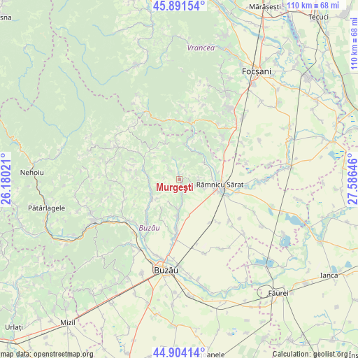
Murgeşti GPS coordinates[2]
45° 24' 0" North, 26° 52' 59.988" East
| Map corner | latitude | longitude |
|---|---|---|
| Upper-left | 45.89154°, | 26.18021° |
| Center: | 45.4°, | 26.88333° |
| Lower-right: | 44.90414°, | 27.58646° |
| Map W x H: | 109.8×109.8 km | = 68.2×68.2mi |
| max Lat: | 48.23793° ⇑57% North |
| Murgeşti: | 45.4° |
| min Lat: | ⇓43% South 43.65638° |
| min Long | Murgeşti | max Long |
| 20.31667° | 26.88333° | 29.65403° |
| W 80.6%⇐ | ⇒19.4% E |
Elevation
Elevation of Murgeşti is 292 m = 958 ft, and this is 37.1 m = 122 ft above average elevation for this country.
| Max E: |
1278 m = 4193 ft | 34.6% |
| Murgeşti | 292 m 958 ft | |
| Avg. | 254.9 m = 836 ft | |
Min E: |
-2 m = -7 ft | 65.4% |
See also: Romania elevation on elevation.city.
Geographical zone
Murgeşti is located in North temperate zone (between Tropic of Cancer and the Arctic Circle). Distance of this North polar circle is 2353.2 km =1462.2 mi to North.| Distance of | km | miles | from Murgeşti |
|---|---|---|---|
| North Pole | 4959.1 | 3081.4 | to North |
| Arctic Circle | 2353.2 | 1462.2 | to North |
| Tropic Cancer | 2442.1 | 1517.5 | to South |
| Equator | 5048 | 3136.7 | to South |


Nearby cities:
15 places around Murgeşti: (largest is in red/bold)
• Beceni
8 km =5 mi,  256°
256°
• Băbeni
9.1 km =5.7 mi,  55°
55°
• Dedulești
10.2 km =6.3 mi,  40°
40°
• Grebănu
6.8 km =4.2 mi,  105°
105°
• Gura Dimienii
9.7 km =6 mi,  272°
272°
• Homești
5.9 km =3.7 mi,  92°
92°
• Livada
5.4 km =3.4 mi, 111°
• Mărgăriteşti
5.4 km =3.4 mi,  313°
313°
• Pardoşi
3.9 km =2.4 mi,  160°
160°
• Petrișoru
7.7 km =4.8 mi,  172°
172°
• Pruneni
7.9 km =4.9 mi,  202°
202°
• Racoviţeni
3.9 km =2.4 mi, 160°
• Topliceni
9.3 km =5.8 mi,  78°
78°
• Vadu Sorești
9.5 km =5.9 mi,  182°
182°
• Valea Părului
9.2 km =5.7 mi,  244°
244°
Sources, notices
• [Note1] Compared only with cities in Romania existing in our database
• [Src1] Map data: © OpenStreetMap contributors (CC-BY-SA)
• [Src2] Other city data from geonames.org with taken over terms of usage.
• [Src3] Geographical zone / Annual Mean Temperature by Robert A. Rohde @ Wikipedia
