Mârşa geodata
Mârşa (Giurgiu) is a seat of a second-order administrative division; located in Romania in Europe/Bucharest (GMT+3) time zone. With population of 2,745 people, there are 1952 cities with bigger population in this country. Compared to other cities in Romania, 89% of cities are located further ↑North; 55.4% of cities are located further ←West and 78.7% of cities have higher elevation than Mârşa. Note1


Mârşa GPS coordinates[2]
44° 22' 27.012" North, 25° 33' 24.984" East
| Map corner | latitude | longitude |
|---|---|---|
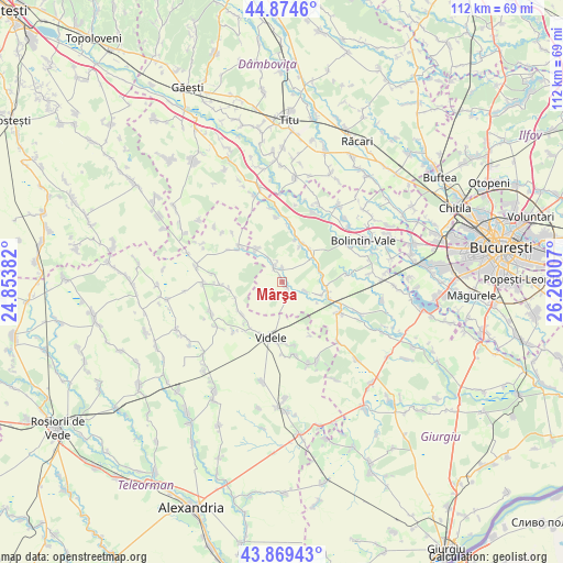
| Upper-left | 44.8746°, | 24.85382° |
| Center: | 44.37417°, | 25.55694° |
| Lower-right: | 43.86943°, | 26.26007° |
| Map W x H: | 111.8×111.8 km | = 69.5×69.5mi |
| max Lat: | 48.23793° ⇑89% North |
| Mârşa: | 44.37417° |
| min Lat: | ⇓11% South 43.65638° |
| min Long | Mârşa | max Long |
| 20.31667° | 25.55694° | 29.65403° |
| W 55.4%⇐ | ⇒44.6% E |
Elevation
Elevation of Mârşa is 99 m = 325 ft, and this is 155.9 m = 511 ft below average elevation for this country.
| Max E: |
1278 m = 4193 ft | 78.7% |
| Avg. | 254.9 m = 836 ft | |
| Mârşa | 99 m = 325 ft | |
Min E: |
-2 m = -7 ft | 21.3% |
See also: Romania elevation on elevation.city.
Geographical zone
Mârşa is located in North temperate zone (between Tropic of Cancer and the Arctic Circle). Distance of this Northern Tropic circle is 2328 km =1446.6 mi to South.| Distance of | km | miles | from Mârşa |
|---|---|---|---|
| North Pole | 5073.1 | 3152.3 | to North |
| Arctic Circle | 2467.2 | 1533 | to North |
| Tropic Cancer | 2328 | 1446.6 | to South |
| Equator | 4933.9 | 3065.8 | to South |


Nearby cities:
15 places around Mârşa: (largest is in red/bold)
• Baciu
10.1 km =6.3 mi,  242°
242°
• Blejeşti
10.9 km =6.8 mi,  221°
221°
• Bucşani
7.8 km =4.8 mi,  88°
88°
• Cartojani
8.4 km =5.2 mi,  320°
320°
• Crevedia Mare
8.2 km =5.1 mi,  41°
41°
• Crevedia Mică
8.6 km =5.3 mi,  29°
29°
• Dealu
7.8 km =4.8 mi,  68°
68°
• Goleasca
3.3 km =2.1 mi,  125°
125°
• Gratia
10.7 km =6.6 mi,  307°
307°
• Găiseanca
9.5 km =5.9 mi,  15°
15°
• Purani
10.6 km =6.6 mi,  262°
262°
• Roata Mică
2.9 km =1.8 mi,  0°
0°
• Roata de Jos
4.2 km =2.6 mi,  345°
345°
• Sadina
4.7 km =2.9 mi,  332°
332°
• Vadu Lat
10 km =6.2 mi,  108°
108°
Sources, notices
• [Note1] Compared only with cities in Romania existing in our database
• [Src1] Map data: © OpenStreetMap contributors (CC-BY-SA)
• [Src2] Other city data from geonames.org with taken over terms of usage.
• [Src3] Geographical zone / Annual Mean Temperature by Robert A. Rohde @ Wikipedia
