Mănăştiur geodata
Mănăştiur (Timiş) is a seat of a second-order administrative division; located in Romania in Europe/Bucharest (GMT+3) time zone. With population of 1,757 people, there are 2864 cities with bigger population in this country. Compared to other cities in Romania, 50.7% of cities are located further ↓South; 93.9% of cities are located further →East and 63.9% of cities have higher elevation than Mănăştiur. Note1


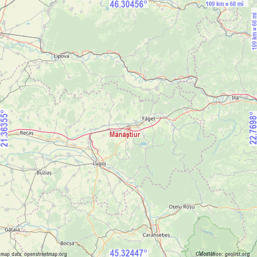
Mănăştiur GPS coordinates[2]
45° 49' 0.012" North, 22° 4' 0.012" East
| Map corner | latitude | longitude |
|---|---|---|
| Upper-left | 46.30456°, | 21.36355° |
| Center: | 45.81667°, | 22.06667° |
| Lower-right: | 45.32447°, | 22.7698° |
| Map W x H: | 109×109 km | = 67.7×67.7mi |
| max Lat: | 48.23793° ⇑49.3% North |
| Mănăştiur: | 45.81667° |
| min Lat: | ⇓50.7% South 43.65638° |
| min Long | Mănăştiur | max Long |
| 20.31667° | 22.06667° | 29.65403° |
| W 6.1%⇐ | ⇒93.9% E |
Elevation
Elevation of Mănăştiur is 151 m = 495 ft, and this is 103.9 m = 341 ft below average elevation for this country.
| Max E: |
1278 m = 4193 ft | 63.9% |
| Avg. | 254.9 m = 836 ft | |
| Mănăştiur | 151 m = 495 ft | |
Min E: |
-2 m = -7 ft | 36.1% |
See also: Romania elevation on elevation.city.
Geographical zone
Mănăştiur is located in North temperate zone (between Tropic of Cancer and the Arctic Circle). Distance of this North polar circle is 2306.8 km =1433.4 mi to North.| Distance of | km | miles | from Mănăştiur |
|---|---|---|---|
| North Pole | 4912.7 | 3052.6 | to North |
| Arctic Circle | 2306.8 | 1433.4 | to North |
| Tropic Cancer | 2488.4 | 1546.2 | to South |
| Equator | 5094.3 | 3165.5 | to South |


Nearby cities:
15 places around Mănăştiur: (largest is in red/bold)
• Bethausen
9 km =5.6 mi,  281°
281°
• Bichigi
7.4 km =4.6 mi,  52°
52°
• Bodo
14.2 km =8.8 mi,  269°
269°
• Bucovăț
7.2 km =4.5 mi,  114°
114°
• Bârna
11.2 km =7 mi,  186°
186°
• Cladova
9.1 km =5.7 mi,  305°
305°
• Dumbrava
3.9 km =2.4 mi,  90°
90°
• Fârdea
12.1 km =7.5 mi,  140°
140°
• Făget
9.8 km =6.1 mi,  67°
67°
• Jupani
3.8 km =2.4 mi,  251°
251°
• Leucușești
5.3 km =3.3 mi,  294°
294°
• Ohaba Lungă
11.9 km =7.4 mi,  328°
328°
• Răchita
3.9 km =2.4 mi, 51°
• Temerești
13.2 km =8.2 mi,  61°
61°
• Traian Vuia
1.9 km =1.2 mi,  180°
180°
Sources, notices
• [Note1] Compared only with cities in Romania existing in our database
• [Src1] Map data: © OpenStreetMap contributors (CC-BY-SA)
• [Src2] Other city data from geonames.org with taken over terms of usage.
• [Src3] Geographical zone / Annual Mean Temperature by Robert A. Rohde @ Wikipedia
