Bethausen geodata
Bethausen (Timiş) is a seat of a second-order administrative division; located in Romania in Europe/Bucharest (GMT+3) time zone. With population of 3,012 people, there are 1757 cities with bigger population in this country. Compared to other cities in Romania, 51% of cities are located further ↓South; 94.8% of cities are located further →East and 71.2% of cities have higher elevation than Bethausen. Note1


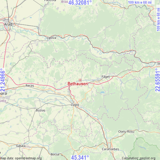
Bethausen GPS coordinates[2]
45° 49' 59.016" North, 21° 57' 10.008" East
| Map corner | latitude | longitude |
|---|---|---|
| Upper-left | 46.32081°, | 21.24966° |
| Center: | 45.83306°, | 21.95278° |
| Lower-right: | 45.341°, | 22.65591° |
| Map W x H: | 108.9×108.9 km | = 67.7×67.7mi |
| max Lat: | 48.23793° ⇑49% North |
| Bethausen: | 45.83306° |
| min Lat: | ⇓51% South 43.65638° |
| min Long | Bethausen | max Long |
| 20.31667° | 21.95278° | 29.65403° |
| W 5.2%⇐ | ⇒94.8% E |
Elevation
Elevation of Bethausen is 123 m = 404 ft, and this is 131.9 m = 433 ft below average elevation for this country.
| Max E: |
1278 m = 4193 ft | 71.2% |
| Avg. | 254.9 m = 836 ft | |
| Bethausen | 123 m = 404 ft | |
Min E: |
-2 m = -7 ft | 28.8% |
See also: Romania elevation on elevation.city.
Geographical zone
Bethausen is located in North temperate zone (between Tropic of Cancer and the Arctic Circle). Distance of this North polar circle is 2305 km =1432.3 mi to North.| Distance of | km | miles | from Bethausen |
|---|---|---|---|
| North Pole | 4910.9 | 3051.5 | to North |
| Arctic Circle | 2305 | 1432.3 | to North |
| Tropic Cancer | 2490.2 | 1547.3 | to South |
| Equator | 5096.2 | 3166.6 | to South |


Nearby cities:
15 places around Bethausen: (largest is in red/bold)
• Balinţ
8 km =5 mi,  253°
253°
• Bara
9.3 km =5.8 mi,  317°
317°
• Bichigi
14.9 km =9.3 mi,  79°
79°
• Bodo
5.7 km =3.5 mi, 250°
• Bârna
15 km =9.3 mi,  149°
149°
• Cladova
3.8 km =2.4 mi,  23°
23°
• Coşteiu
13 km =8.1 mi,  218°
218°
• Dumbrava
12.8 km =8 mi,  98°
98°
• Jupani
6.1 km =3.8 mi,  120°
120°
• Leucușești
4 km =2.5 mi,  85°
85°
• Mănăştiur
9 km =5.6 mi, 101°
• Ohaba Lungă
8.6 km =5.3 mi, 16°
• Răchita
11.9 km =7.4 mi, 87°
• Secaş
11.8 km =7.3 mi,  299°
299°
• Traian Vuia
9.6 km =6 mi,  112°
112°
Sources, notices
• [Note1] Compared only with cities in Romania existing in our database
• [Src1] Map data: © OpenStreetMap contributors (CC-BY-SA)
• [Src2] Other city data from geonames.org with taken over terms of usage.
• [Src3] Geographical zone / Annual Mean Temperature by Robert A. Rohde @ Wikipedia
