Lunca geodata
Lunca (Botoşani) is a seat of a second-order administrative division; located in Romania in Europe/Bucharest (GMT+3) time zone. With population of 4,921 people, there are 814 cities with bigger population in this country. Compared to other cities in Romania, 93.3% of cities are located further ↓South; 82.6% of cities are located further ←West and 76.7% of cities have higher elevation than Lunca. Note1


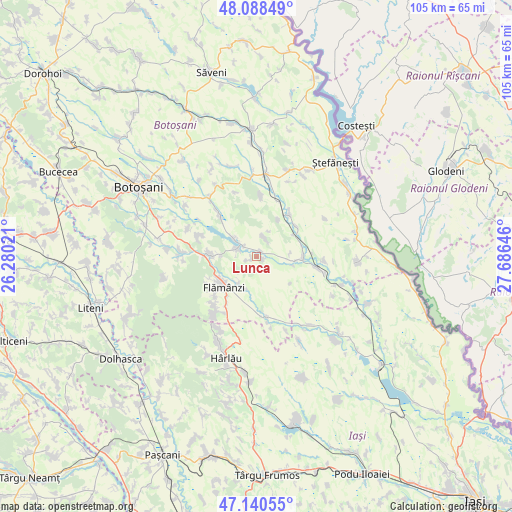
Lunca GPS coordinates[2]
47° 37' 0.012" North, 26° 58' 59.988" East
| Map corner | latitude | longitude |
|---|---|---|
| Upper-left | 48.08849°, | 26.28021° |
| Center: | 47.61667°, | 26.98333° |
| Lower-right: | 47.14055°, | 27.68646° |
| Map W x H: | 105.4×105.4 km | = 65.5×65.5mi |
| max Lat: | 48.23793° ⇑6.7% North |
| Lunca: | 47.61667° |
| min Lat: | ⇓93.3% South 43.65638° |
| min Long | Lunca | max Long |
| 20.31667° | 26.98333° | 29.65403° |
| W 82.6%⇐ | ⇒17.4% E |
Elevation
Elevation of Lunca is 105 m = 344 ft, and this is 149.9 m = 492 ft below average elevation for this country.
| Max E: |
1278 m = 4193 ft | 76.7% |
| Avg. | 254.9 m = 836 ft | |
| Lunca | 105 m = 344 ft | |
Min E: |
-2 m = -7 ft | 23.3% |
See also: Romania elevation on elevation.city.
Geographical zone
Lunca is located in North temperate zone (between Tropic of Cancer and the Arctic Circle). Distance of this North polar circle is 2106.7 km =1309 mi to North.| Distance of | km | miles | from Lunca |
|---|---|---|---|
| North Pole | 4712.6 | 2928.3 | to North |
| Arctic Circle | 2106.7 | 1309 | to North |
| Tropic Cancer | 2688.6 | 1670.6 | to South |
| Equator | 5294.5 | 3289.8 | to South |


Nearby cities:
15 places around Lunca: (largest is in red/bold)
• Buimăceni
10.1 km =6.3 mi,  52°
52°
• Cerbu
7.3 km =4.5 mi,  270°
270°
• Cernești
8.5 km =5.3 mi,  94°
94°
• Chițoveni
6.7 km =4.2 mi,  214°
214°
• Cotu
9.4 km =5.8 mi,  257°
257°
• Coștiugeni
8.9 km =5.5 mi,  30°
30°
• Dracșani
4.2 km =2.6 mi,  289°
289°
• Iurești
7.7 km =4.8 mi,  76°
76°
• Jijia
9.3 km =5.8 mi,  67°
67°
• Nicolae Bălcescu
8.6 km =5.3 mi,  229°
229°
• Prisăcani
7 km =4.3 mi,  201°
201°
• Stroiești
1.5 km =0.9 mi,  242°
242°
• Sulița
6.2 km =3.9 mi,  306°
306°
• Todireni
10 km =6.2 mi, 90°
• Zlătunoaia
4.1 km =2.5 mi, 25°
Sources, notices
• [Note1] Compared only with cities in Romania existing in our database
• [Src1] Map data: © OpenStreetMap contributors (CC-BY-SA)
• [Src2] Other city data from geonames.org with taken over terms of usage.
• [Src3] Geographical zone / Annual Mean Temperature by Robert A. Rohde @ Wikipedia
