Intregalde geodata
Intregalde (Alba) is a seat of a second-order administrative division; located in Romania in Europe/Bucharest (GMT+3) time zone. With population of 860 people, there are 4784 cities with bigger population in this country. Compared to other cities in Romania, 60.8% of cities are located further ↓South; 78.3% of cities are located further →East and 96% of cities have lower elevation than Intregalde. Note1


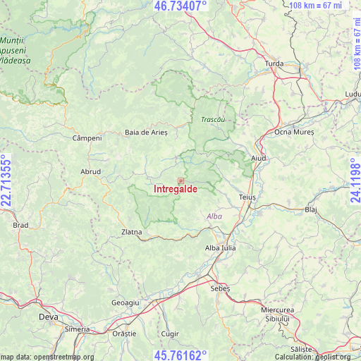
Intregalde GPS coordinates[2]
46° 15' 0" North, 23° 25' 0.012" East
| Map corner | latitude | longitude |
|---|---|---|
| Upper-left | 46.73407°, | 22.71355° |
| Center: | 46.25°, | 23.41667° |
| Lower-right: | 45.76162°, | 24.1198° |
| Map W x H: | 108.1×108.1 km | = 67.2×67.2mi |
| max Lat: | 48.23793° ⇑39.2% North |
| Intregalde: | 46.25° |
| min Lat: | ⇓60.8% South 43.65638° |
| min Long | Intregalde | max Long |
| 20.31667° | 23.41667° | 29.65403° |
| W 21.7%⇐ | ⇒78.3% E |
Elevation
Elevation of Intregalde is 669 m = 2195 ft, and this is 414.1 m = 1359 ft above average elevation for this country.
| Max E: |
1278 m = 4193 ft | 4% |
| Intregalde | 669 m 2195 ft | |
| Avg. | 254.9 m = 836 ft | |
Min E: |
-2 m = -7 ft | 96% |
See also: Romania elevation on elevation.city.
Geographical zone
Intregalde is located in North temperate zone (between Tropic of Cancer and the Arctic Circle). Distance of this North polar circle is 2258.7 km =1403.5 mi to North.| Distance of | km | miles | from Intregalde |
|---|---|---|---|
| North Pole | 4864.5 | 3022.7 | to North |
| Arctic Circle | 2258.7 | 1403.5 | to North |
| Tropic Cancer | 2536.6 | 1576.2 | to South |
| Equator | 5142.5 | 3195.4 | to South |


Nearby cities:
15 places around Intregalde: (largest is in red/bold)
• Ampoița
14.9 km =9.3 mi,  170°
170°
• Benic
14.1 km =8.8 mi,  106°
106°
• Brusturei
10.5 km =6.5 mi,  58°
58°
• Bucerdea Vinoasă
13 km =8.1 mi,  138°
138°
• Bucium
15.5 km =9.6 mi,  263°
263°
• Cetea
13 km =8.1 mi,  96°
96°
• Cricău
13.7 km =8.5 mi,  122°
122°
• Geoagiu de Sus
13.5 km =8.4 mi,  87°
87°
• Ighiel
12.5 km =7.8 mi,  157°
157°
• Ighiu
13.5 km =8.4 mi,  145°
145°
• Mogoș
10.9 km =6.8 mi,  285°
285°
• Poienile-Mogoş
10.9 km =6.8 mi, 289°
• Ponor
9.3 km =5.8 mi,  0°
0°
• Șard
16.3 km =10.1 mi, 146°
• Țelna
12 km =7.5 mi, 147°
Sources, notices
• [Note1] Compared only with cities in Romania existing in our database
• [Src1] Map data: © OpenStreetMap contributors (CC-BY-SA)
• [Src2] Other city data from geonames.org with taken over terms of usage.
• [Src3] Geographical zone / Annual Mean Temperature by Robert A. Rohde @ Wikipedia
