Gorban geodata
Gorban (Iaşi) is a seat of a second-order administrative division; located in Romania in Europe/Bucharest (GMT+3) time zone. With population of 2,991 people, there are 1771 cities with bigger population in this country. Compared to other cities in Romania, 75.9% of cities are located further ↓South; 97% of cities are located further ←West and 90.7% of cities have higher elevation than Gorban. Note1


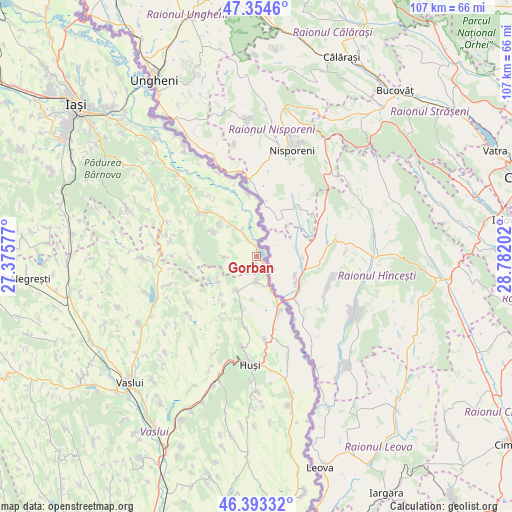
Gorban GPS coordinates[2]
46° 52' 33.996" North, 28° 4' 44.004" East
| Map corner | latitude | longitude |
|---|---|---|
| Upper-left | 47.3546°, | 27.37577° |
| Center: | 46.87611°, | 28.07889° |
| Lower-right: | 46.39332°, | 28.78202° |
| Map W x H: | 106.9×106.9 km | = 66.4×66.4mi |
| max Lat: | 48.23793° ⇑24.1% North |
| Gorban: | 46.87611° |
| min Lat: | ⇓75.9% South 43.65638° |
| min Long | Gorban | max Long |
| 20.31667° | 28.07889° | 29.65403° |
| W 97%⇐ | ⇒3% E |
Elevation
Elevation of Gorban is 55 m = 180 ft, and this is 199.9 m = 656 ft below average elevation for this country.
| Max E: |
1278 m = 4193 ft | 90.7% |
| Avg. | 254.9 m = 836 ft | |
| Gorban | 55 m = 180 ft | |
Min E: |
-2 m = -7 ft | 9.3% |
See also: Romania elevation on elevation.city.
Geographical zone
Gorban is located in North temperate zone (between Tropic of Cancer and the Arctic Circle). Distance of this North polar circle is 2189 km =1360.2 mi to North.| Distance of | km | miles | from Gorban |
|---|---|---|---|
| North Pole | 4794.9 | 2979.4 | to North |
| Arctic Circle | 2189 | 1360.2 | to North |
| Tropic Cancer | 2606.2 | 1619.4 | to South |
| Equator | 5212.1 | 3238.6 | to South |


Nearby cities:
15 places around Gorban: (largest is in red/bold)
• Arsura
8.2 km =5.1 mi,  211°
211°
• Bohotin
10.4 km =6.5 mi,  312°
312°
• Buneşti
9.8 km =6.1 mi,  240°
240°
• Băile Drânceni
7.1 km =4.4 mi,  166°
166°
• Cozmeşti
7.3 km =4.5 mi,  276°
276°
• Drânceni
9.3 km =5.8 mi,  153°
153°
• Fundătura
10 km =6.2 mi, 205°
• Ghermănești
5.1 km =3.2 mi,  178°
178°
• Moşna
10.8 km =6.7 mi,  294°
294°
• Pietriș
12.1 km =7.5 mi,  274°
274°
• Podolenii de Sus
5.3 km =3.3 mi,  246°
246°
• Podu Hagiului
1.7 km =1.1 mi, 181°
• Pâhnești
11.1 km =6.9 mi,  196°
196°
• Râșești
12.5 km =7.8 mi,  157°
157°
• Scoposeni
5.8 km =3.6 mi,  12°
12°
Sources, notices
• [Note1] Compared only with cities in Romania existing in our database
• [Src1] Map data: © OpenStreetMap contributors (CC-BY-SA)
• [Src2] Other city data from geonames.org with taken over terms of usage.
• [Src3] Geographical zone / Annual Mean Temperature by Robert A. Rohde @ Wikipedia
