Arsura geodata
Arsura (Vaslui) is a seat of a second-order administrative division; located in Romania in Europe/Bucharest (GMT+3) time zone. With population of 1,984 people, there are 2615 cities with bigger population in this country. Compared to other cities in Romania, 74.4% of cities are located further ↓South; 96.5% of cities are located further ←West and 51.8% of cities have higher elevation than Arsura. Note1


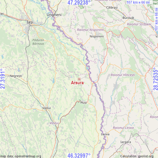
Arsura GPS coordinates[2]
46° 48' 47.988" North, 28° 1' 19.992" East
| Map corner | latitude | longitude |
|---|---|---|
| Upper-left | 47.29238°, | 27.3191° |
| Center: | 46.81333°, | 28.02222° |
| Lower-right: | 46.32997°, | 28.72535° |
| Map W x H: | 107×107 km | = 66.5×66.5mi |
| max Lat: | 48.23793° ⇑25.6% North |
| Arsura: | 46.81333° |
| min Lat: | ⇓74.4% South 43.65638° |
| min Long | Arsura | max Long |
| 20.31667° | 28.02222° | 29.65403° |
| W 96.5%⇐ | ⇒3.5% E |
Elevation
Elevation of Arsura is 202 m = 663 ft, and this is 52.9 m = 174 ft below average elevation for this country.
| Max E: |
1278 m = 4193 ft | 51.8% |
| Avg. | 254.9 m = 836 ft | |
| Arsura | 202 m = 663 ft | |
Min E: |
-2 m = -7 ft | 48.2% |
See also: Romania elevation on elevation.city.
Geographical zone
Arsura is located in North temperate zone (between Tropic of Cancer and the Arctic Circle). Distance of this North polar circle is 2196 km =1364.5 mi to North.| Distance of | km | miles | from Arsura |
|---|---|---|---|
| North Pole | 4801.9 | 2983.8 | to North |
| Arctic Circle | 2196 | 1364.5 | to North |
| Tropic Cancer | 2599.2 | 1615.1 | to South |
| Equator | 5205.2 | 3234.4 | to South |


Nearby cities:
15 places around Arsura: (largest is in red/bold)
• Boţeşti
10.7 km =6.6 mi,  262°
262°
• Brădicești
9.9 km =6.2 mi,  293°
293°
• Buneşti
4.8 km =3 mi,  297°
297°
• Băile Drânceni
6 km =3.7 mi,  89°
89°
• Cozmeşti
8.3 km =5.2 mi,  339°
339°
• Drânceni
8.5 km =5.3 mi,  98°
98°
• Duda
6.9 km =4.3 mi,  170°
170°
• Fundătura
2 km =1.2 mi,  179°
179°
• Ghermănești
4.8 km =3 mi,  67°
67°
• Gorban
8.2 km =5.1 mi,  31°
31°
• Gugești
10.8 km =6.7 mi,  239°
239°
• Podolenii de Sus
4.9 km =3 mi,  353°
353°
• Podu Hagiului
6.8 km =4.2 mi,  38°
38°
• Pâhnești
3.8 km =2.4 mi,  162°
162°
• Râșești
10.3 km =6.4 mi,  116°
116°
Sources, notices
• [Note1] Compared only with cities in Romania existing in our database
• [Src1] Map data: © OpenStreetMap contributors (CC-BY-SA)
• [Src2] Other city data from geonames.org with taken over terms of usage.
• [Src3] Geographical zone / Annual Mean Temperature by Robert A. Rohde @ Wikipedia
