Ferești geodata
Ferești (Maramureş) is a populated place; located in Romania in Europe/Bucharest (GMT+3) time zone. With population of 507 people, there are 6971 cities with bigger population in this country. Compared to other cities in Romania, 97.1% of cities are located further ↓South; 70.2% of cities are located further →East and 70% of cities have lower elevation than Ferești. Note1


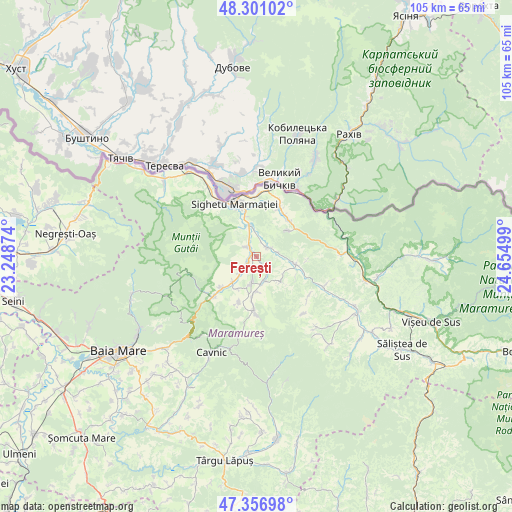
Ferești GPS coordinates[2]
47° 49' 52.14" North, 23° 57' 6.696" East
| Map corner | latitude | longitude |
|---|---|---|
| Upper-left | 48.30102°, | 23.24874° |
| Center: | 47.83115°, | 23.95186° |
| Lower-right: | 47.35698°, | 24.65499° |
| Map W x H: | 105×105 km | = 65.2×65.2mi |
| max Lat: | 48.23793° ⇑2.9% North |
| Ferești: | 47.83115° |
| min Lat: | ⇓97.1% South 43.65638° |
| min Long | Ferești | max Long |
| 20.31667° | 23.95186° | 29.65403° |
| W 29.8%⇐ | ⇒70.2% E |
Elevation
Elevation of Ferești is 321 m = 1053 ft, and this is 66.1 m = 217 ft above average elevation for this country.
| Max E: |
1278 m = 4193 ft | 30% |
| Ferești | 321 m 1053 ft | |
| Avg. | 254.9 m = 836 ft | |
Min E: |
-2 m = -7 ft | 70% |
See also: Romania elevation on elevation.city.
Geographical zone
Ferești is located in North temperate zone (between Tropic of Cancer and the Arctic Circle). Distance of this North polar circle is 2082.8 km =1294.2 mi to North.| Distance of | km | miles | from Ferești |
|---|---|---|---|
| North Pole | 4688.7 | 2913.4 | to North |
| Arctic Circle | 2082.8 | 1294.2 | to North |
| Tropic Cancer | 2712.4 | 1685.4 | to South |
| Equator | 5318.3 | 3304.6 | to South |


Nearby cities:
15 places around Ferești: (largest is in red/bold)
• Berbești
2.3 km =1.4 mi,  326°
326°
• Cornești
2 km =1.2 mi,  142°
142°
• Coștiui
7.9 km =4.9 mi,  47°
47°
• Călineşti
5.4 km =3.4 mi,  165°
165°
• Giuleşti
2.1 km =1.3 mi,  220°
220°
• Hărnicești
7.3 km =4.5 mi, 221°
• Lazu Baciului
8.6 km =5.3 mi,  344°
344°
• Nănești
4.5 km =2.8 mi,  80°
80°
• Ocna Şugatag
5.5 km =3.4 mi,  194°
194°
• Oncești
2.9 km =1.8 mi, 49°
• Sat-Șugatag
5 km =3.1 mi, 222°
• Sârbi
7.7 km =4.8 mi,  183°
183°
• Vadu Izei
6.5 km =4 mi,  346°
346°
• Valea Stejarului
5.6 km =3.5 mi,  30°
30°
• Văleni
7 km =4.3 mi, 136°
Sources, notices
• [Note1] Compared only with cities in Romania existing in our database
• [Src1] Map data: © OpenStreetMap contributors (CC-BY-SA)
• [Src2] Other city data from geonames.org with taken over terms of usage.
• [Src3] Geographical zone / Annual Mean Temperature by Robert A. Rohde @ Wikipedia
